
Skoda Kylaq Pune to Prague Leg 1: To the home away from home

Skoda Kylaq Pune to Prague Leg 1: To the home away from home
skoda kylaq p2p

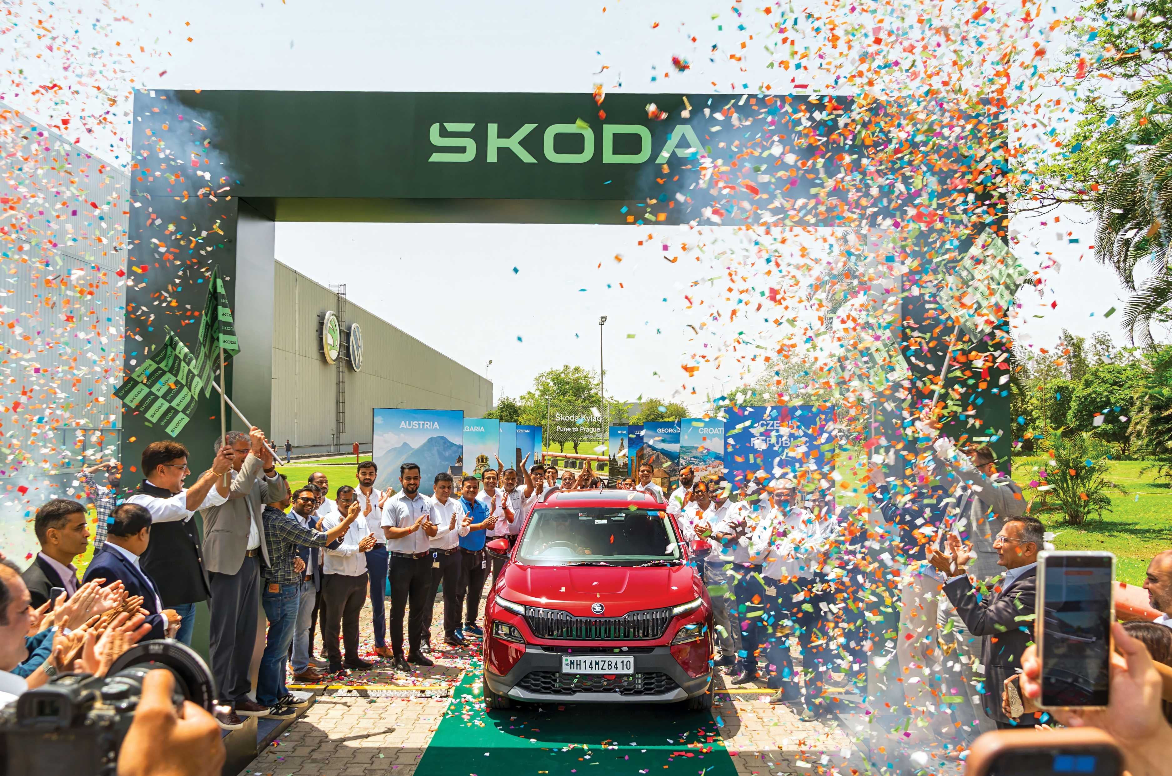
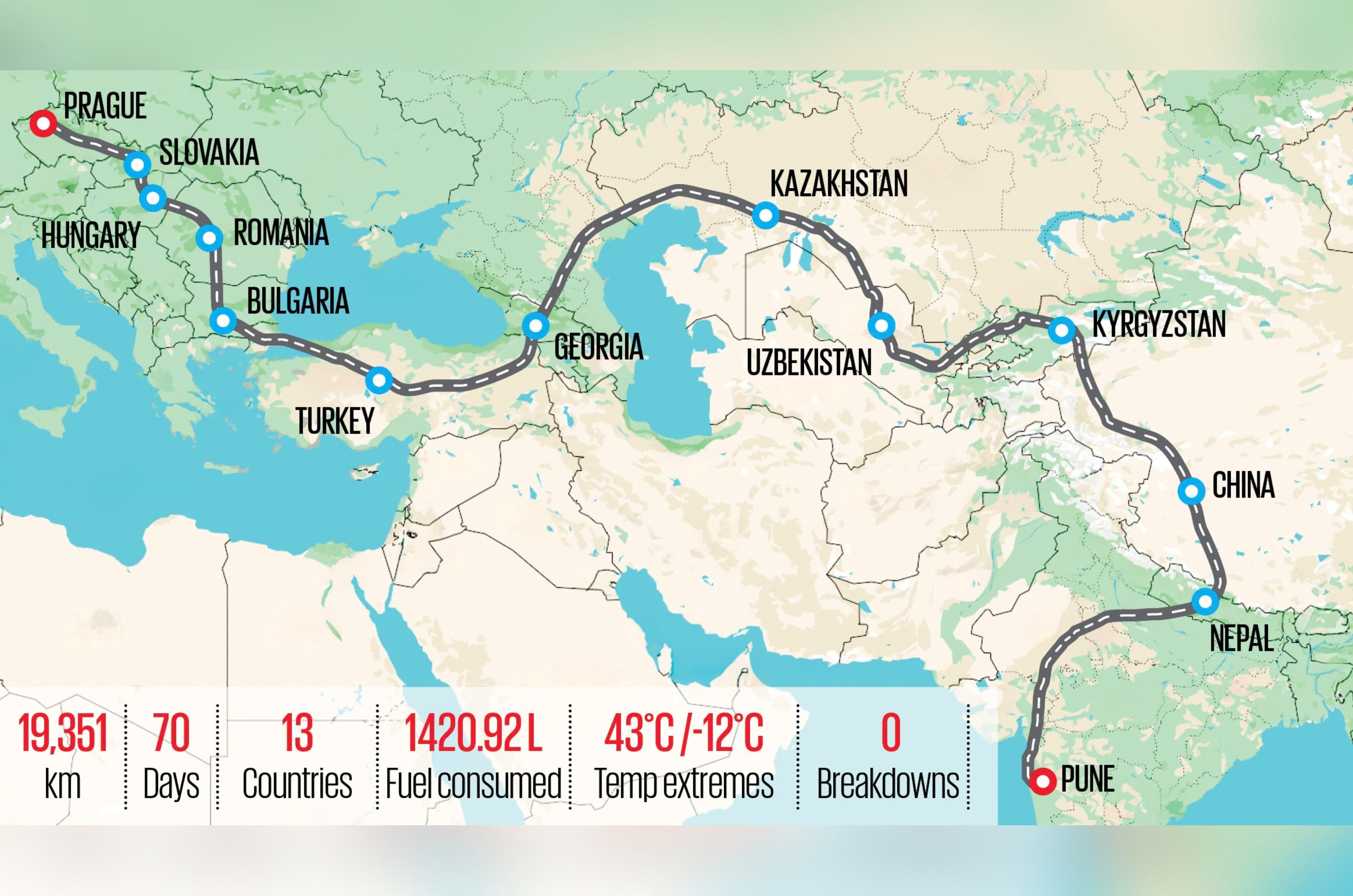
There are road trips, there are overland expeditions, and then there are journeys that become conversations with continents. This one starts in the industrial heart of Maharashtra, inside Skoda India’s sprawling Chakan facility. The end point lies nearly 20,000 kilometres away at Skoda Auto’s headquarters near Prague in Mladá Boleslav, Czech Republic, where bicycles evolved into automobiles and a 130-year-old story continues to be written.

Between these two factories lie thirteen countries, four major mountain ranges, countless cuisines, dozens of languages and enough history to fill libraries.
Our companion? Not a flagship SUV or a luxury grand tourer, but Skoda’s smallest SUV – the Kylaq, which recently celebrated its one-year anniversary. Driving it from Pune to Prague is a tall order, but surviving one year in India and being accepted with flying colours is enough cred one needs to take on the world.

India – Home Turf
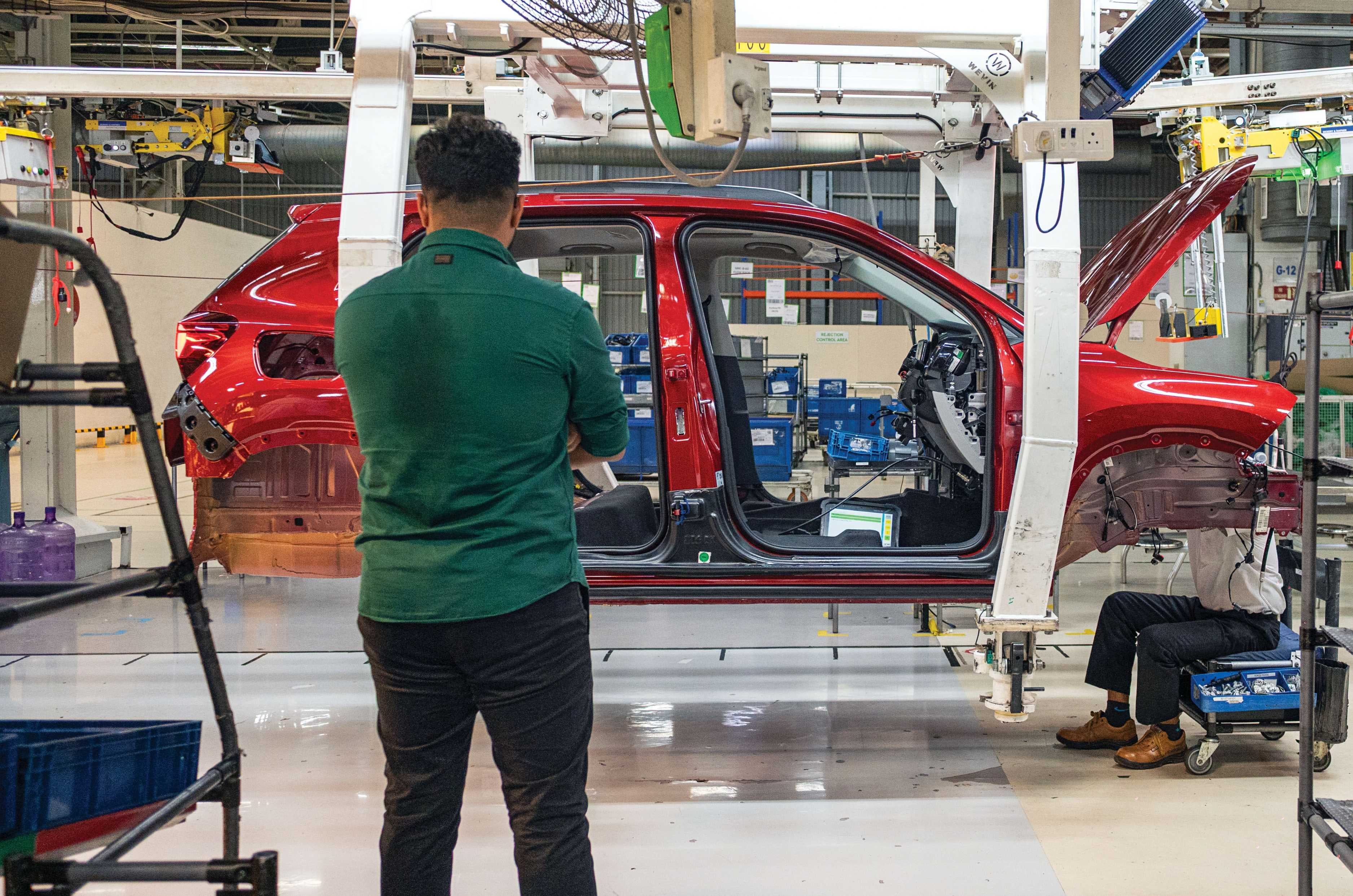
Witnessing the Kylaq’s birth added more responsibility.

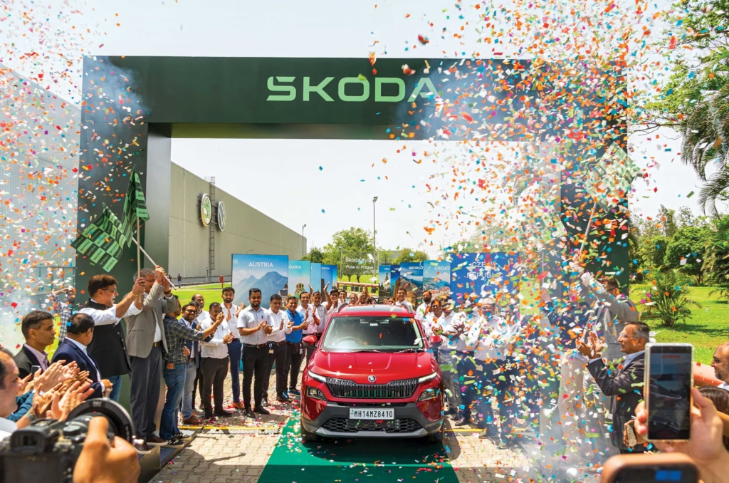
On a cross-country road trip, you’d imagine the home country would be the easiest leg. With India, it was the opposite. To some, it’s organised chaos, but honestly, it’s anything but organised. Erratic traffic, erratic egos, and road conditions fit only for a Mars rover – India was the biggest challenge on the drive from Pune to Prague. As the odometer ticked over its first kilometre, right outside the gate of Skoda’s Chakan plant, a blood-red PMPML bus was ready to trade paint with the cherry-red Kylaq. A dinged-up Kylaq parked on the streets of Prague wouldn’t be a good look, so it was imperative that I babysit this compact SUV like a million-dollar supercar. Having watched the car being assembled on the factory floor, from bare bones to the finished package, only added to the emotion – driving it in traffic felt like walking a toddler across a football field. Eyes wide open, ready to block any attack.
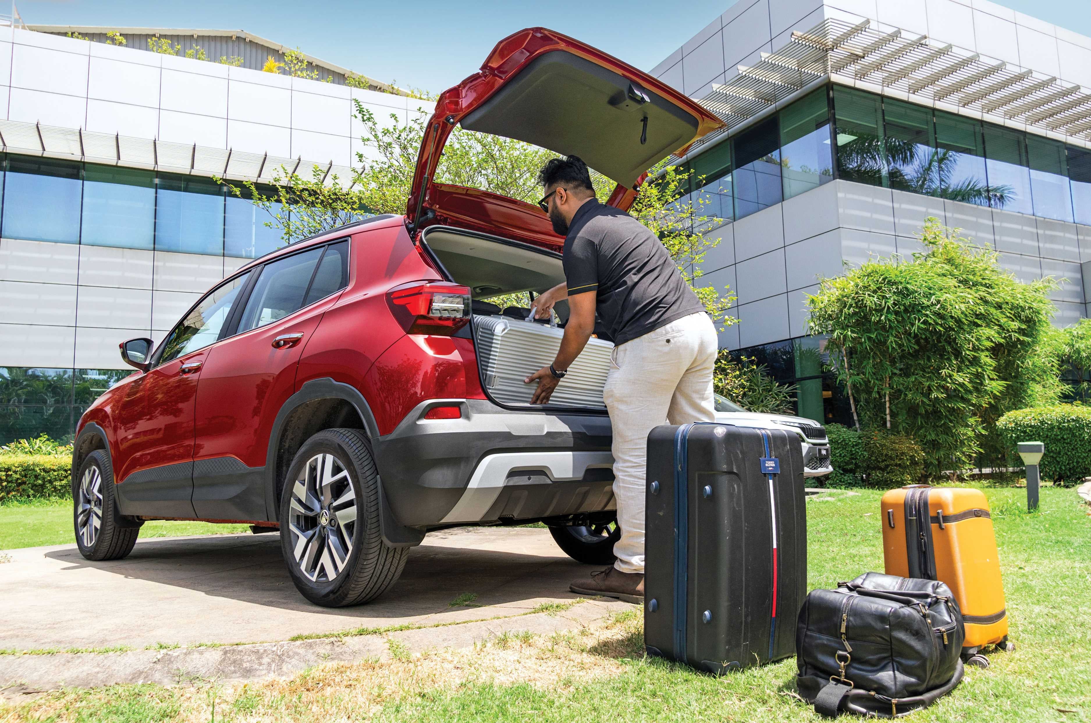
446-litre boot packed to the brim for 70 days on the road.

We got onto the Pune expressway and then crossed the Atal Setu in Mumbai, the longest sea bridge on the entire journey. Mumbai was home, both to me and to the Autocar India office, so after a few greetings from co-workers and the obligatory photos, we headed towards our first state crossing. The infamous Western Express Highway that leads out of Mumbai lived up to its reputation, but with a little anxiety, panic and a few expletives, we made it onto the national highway.
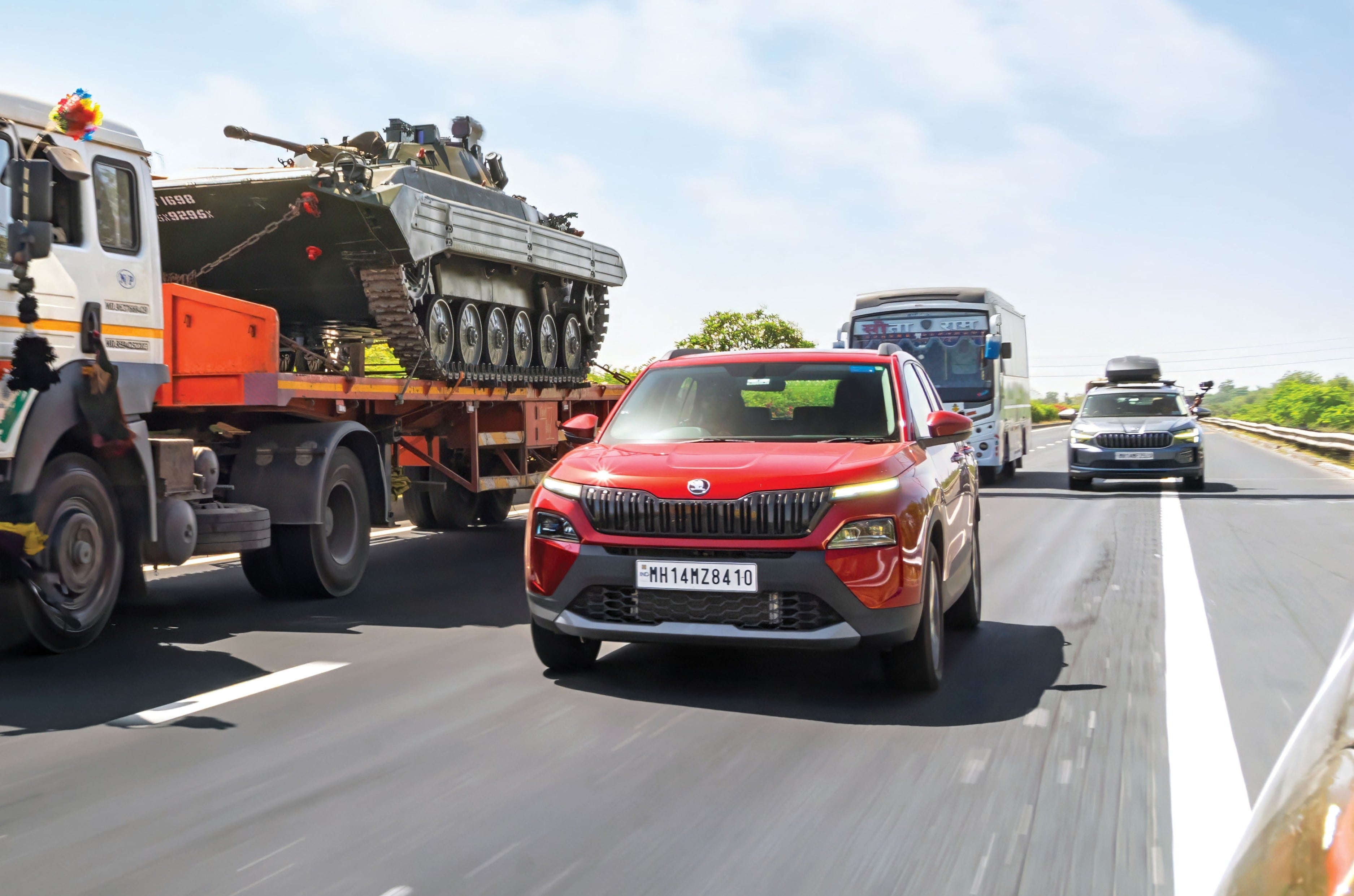
No telling what you’d spot on Indian highways.

The first of countless food stops was Hotel Ahura, renowned for its akuri and kheema. Needless to say, we carb-loaded to the max and made a beeline for Vadodara.

Pune-Birgunj in numbers

Distance covered2,487km
Fuel consumed234.46 litres
Average fuel economy10.62kpl
Approximate fuel costRs 23,629
Average per-litre fuel costRs 100.87
Total time driven55hrs 20min
Average speed44.95kph

Crossing into Gujarat, the Kylaq could finally stretch its legs and spool up that turbo on the state’s spotless highways. The stability and effortless cruising were a welcome relief, since the bulk of the kilometres on this drive would be covered on long, open highways. Gujarat was a short stint – we made only an overnight halt in Vadodara before slipping out ahead of the morning traffic. The drive into Rajasthan was seamless, and Udaipur greeted us with a mix of heat and traffic. The City of Lakes is worth taking the time to explore, but a late arrival and early morning departure left us with just enough time to grab a traditional meal. All that driving had built up an appetite, so we put it to a vote between a massive vegetarian thali and laal maas – the latter won by a landslide. From the City of Lakes, we headed to Jaipur, the Pink City: just as picturesque as Udaipur, and just as colourful and chaotic. The sun setting over the beautiful Amer Fort made for a cracking backdrop, and a few glimpses of the Jal Mahal on the way back were a treat too. The iconic Hawa Mahal, with its 953 windows, never fails to amuse, but getting a photo of the five-storey icon without a chorus of honks is next to impossible. The next morning, after threading through Jaipur’s narrow lanes, we made it back onto the highway, heading for Agra.
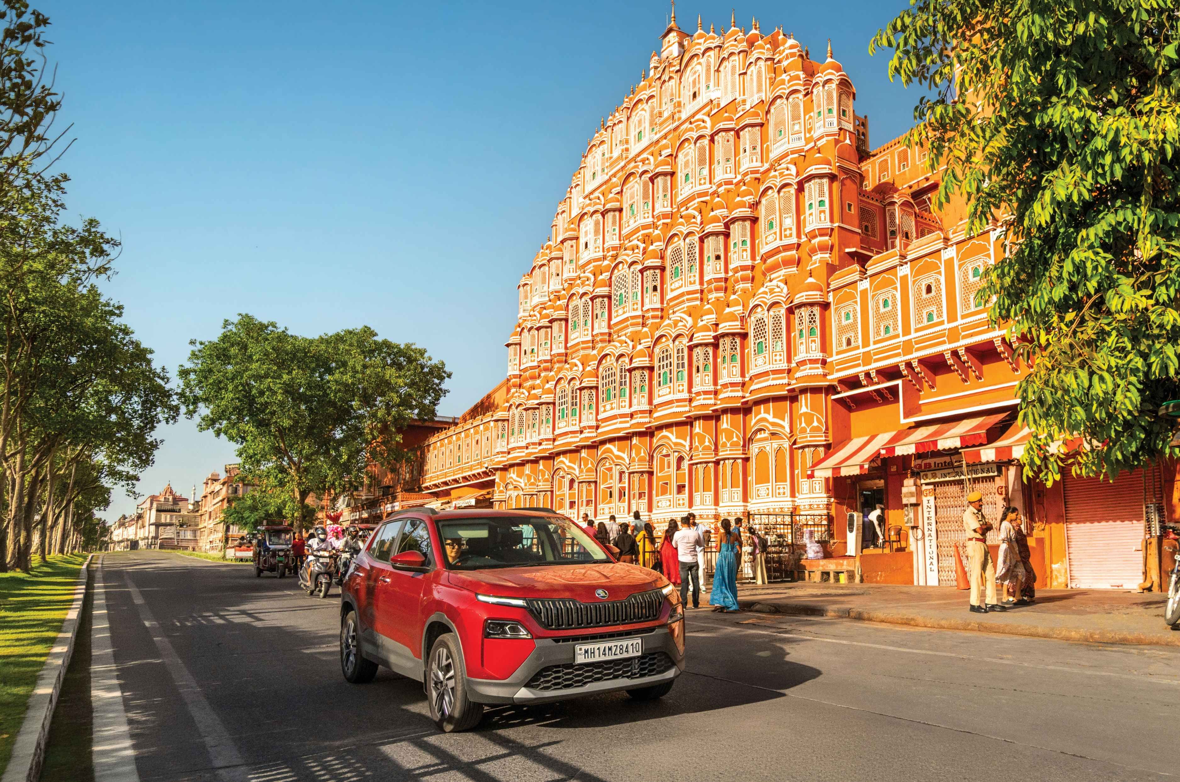
Iconic Hawa Mahal ought to be seen first-hand.

Agra is synonymous with the Taj Mahal, but the Agra Fort – from which you can see the Taj in the distance – is just as mesmerising. The detailing and architecture are second to none, and you could spend hours walking through its courtyards and passages, taking endless pictures. We, of course, also made it to the Taj itself, amid the hordes of tourists, if only to avoid the guilt of visiting Agra without a shot of the world-famous white dome. Tourism done, it was time for some petha – though the lanes near the petha shops seemed to be the exact width of the Kylaq, and that’s where peak anxiety set in. We got out of the mess, walked around the car to check for scratches and scribbles, and sighed in relief. India was adding to the tension, and we were barely halfway through it.
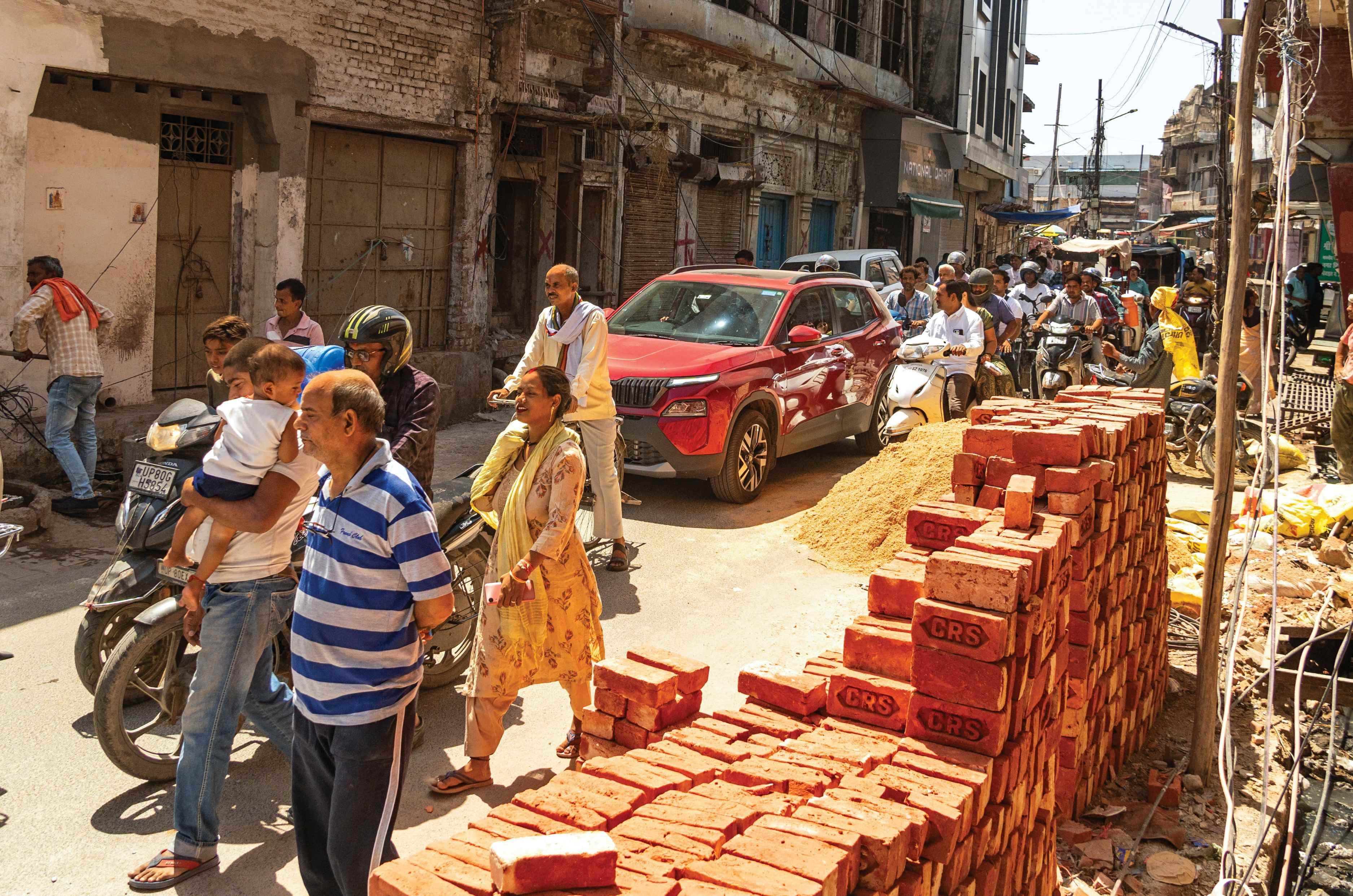
Agra’s narrow lanes were a nightmare to drive through.

Our next stop from Agra was foodie heaven – Lucknow. The biryanis, kebabs, and tandoors were exactly what we expected, and exactly what Lucknow delivered. Finding your way here is easy – you could do it blindfolded, following the smoke and sizzle to wherever you need to be. Tunday Kababi is a must, and after a heap of biryani laced with kebabs, a long walk through the countless chikankari shops helps burn off some of the calories.
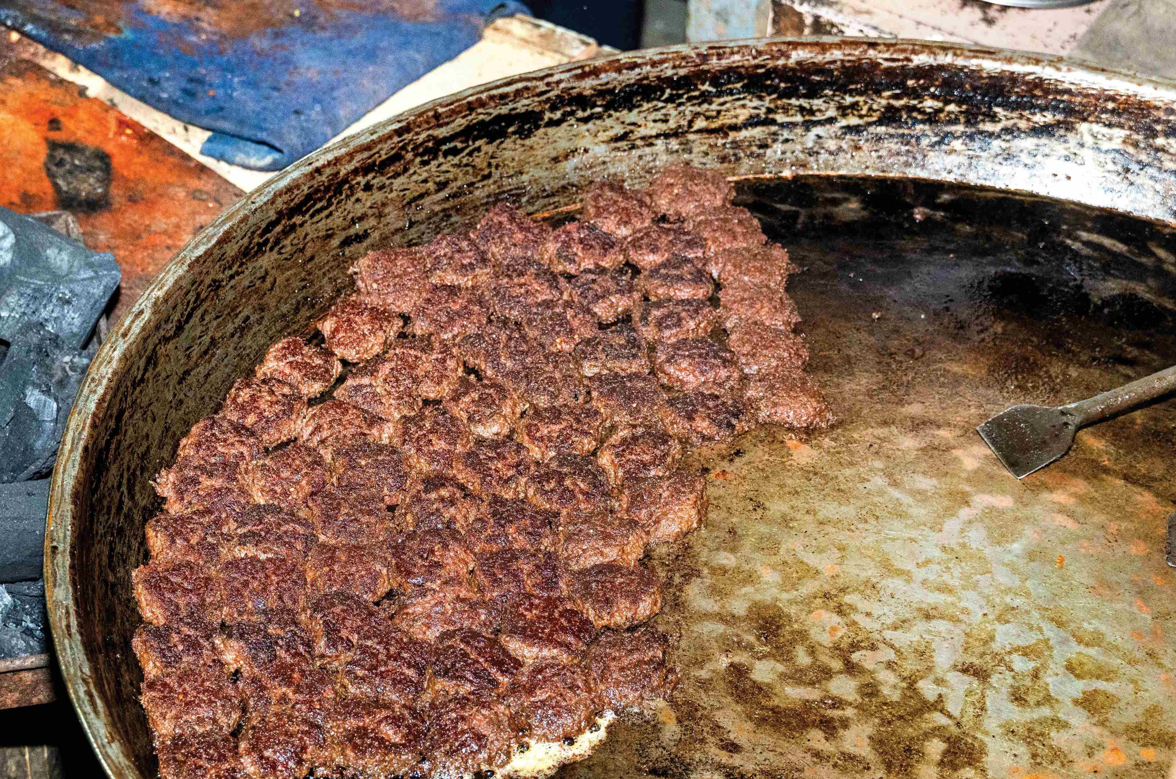
Lucknow’s Tunday Kababi still has us drooling over Galouti kebabs.

We were closing in on the end of the India leg, with one last stop in Gorakhpur before the Nepal border. To celebrate, a group of Skoda owners, officially known as the ‘Fans of Skoda’ joined us for a celebratory convoy as we drove out – everything from Octavia RS models to Kodiaqs and Kushaqs turned up as a send-off before we went international. The loud, chaotic border towns past Gorakhpur delivered one final challenge as we exited through Raxaul.
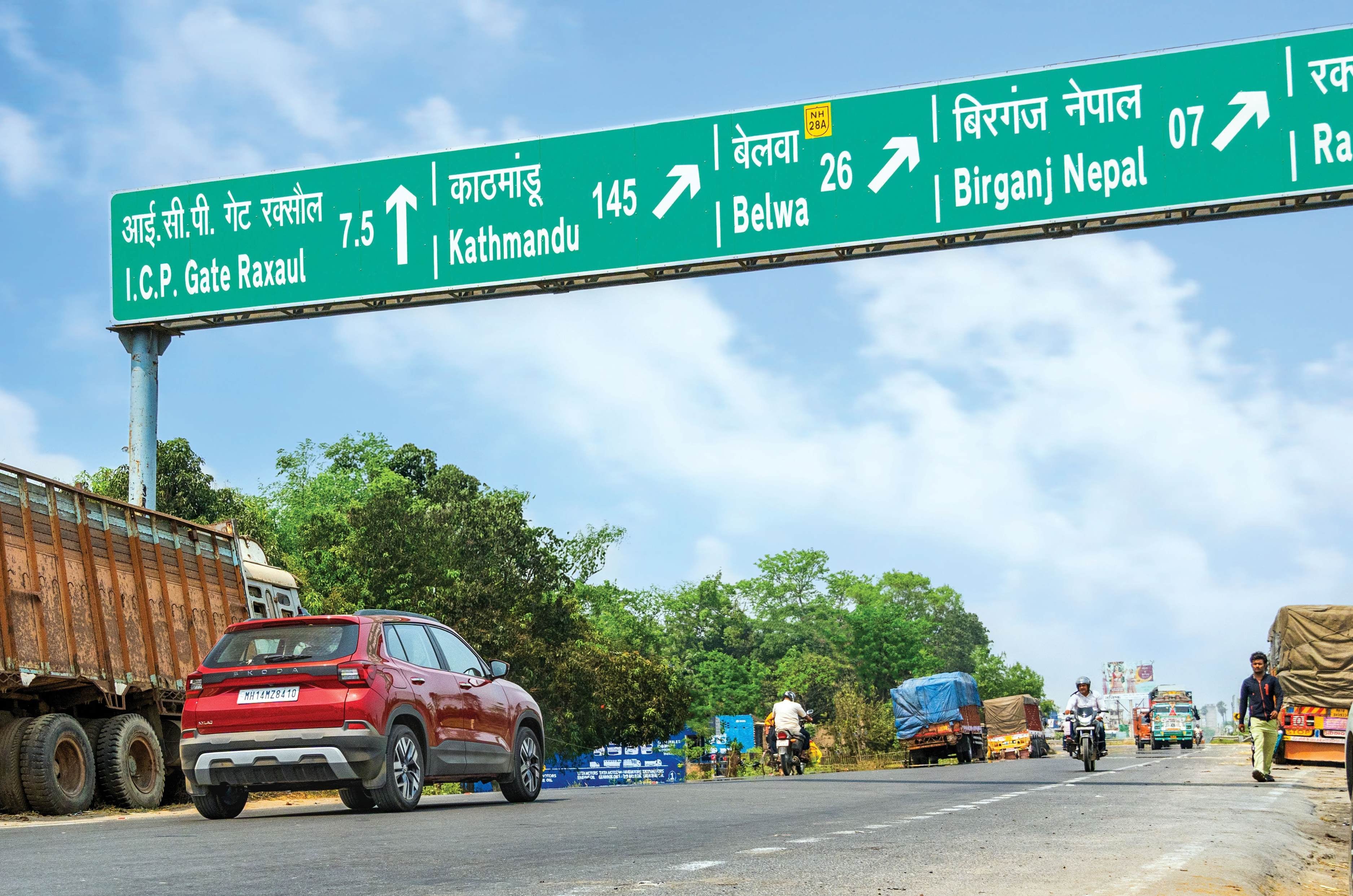
Final stretch before the Kylaq left India for the first time.

The India-Nepal border is still raw and basic, with none of the high-tech systems you might expect. A drive of this scale comes with a mountain of paperwork – visas, carnets, insurance, and more – and sifting through all of it manually takes a while. After a gruelling five hours, the Kylaq crossed out of India for the very first time.

Nepal – Old World Charm
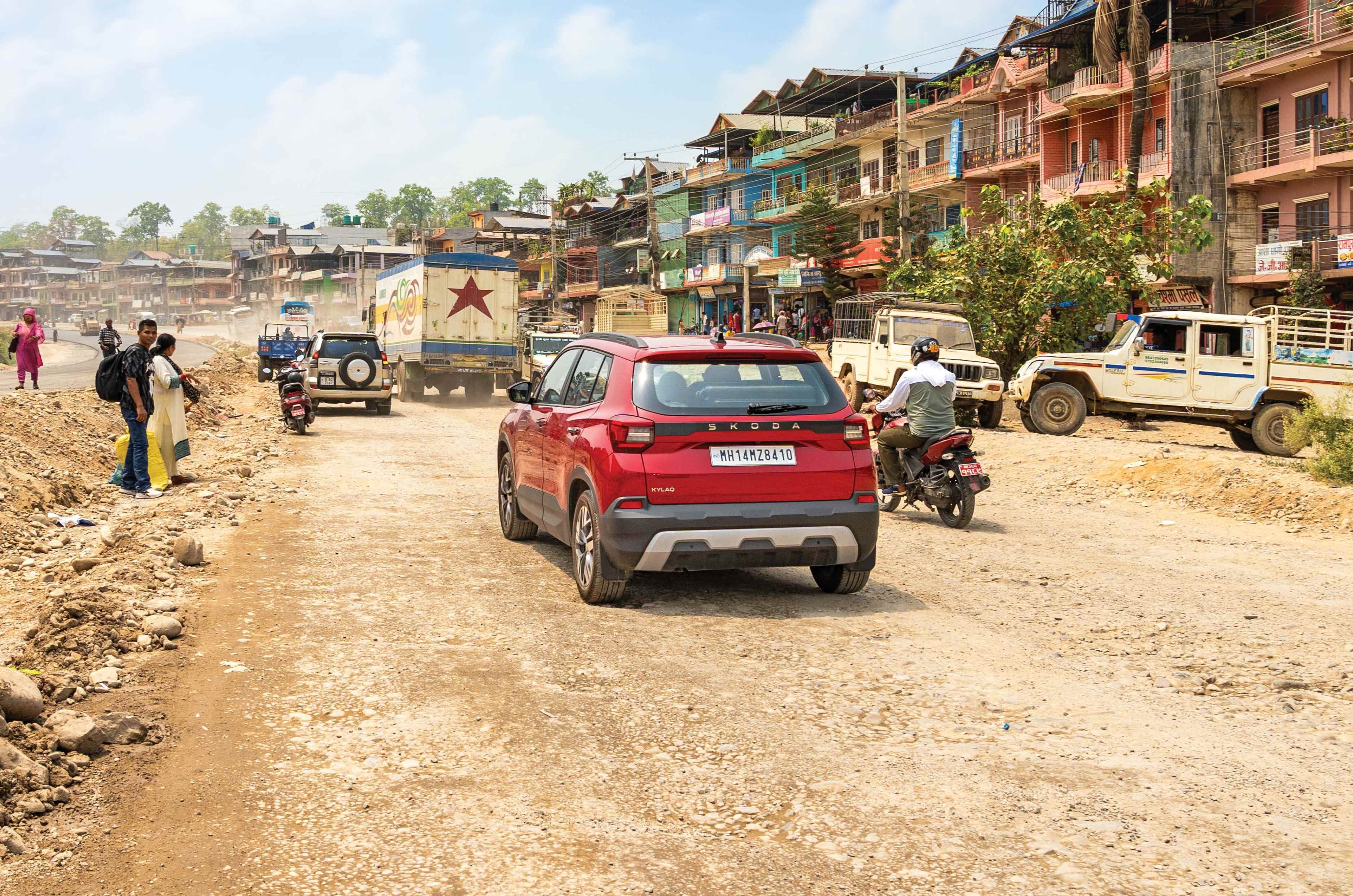
Nepal’s state highways give Indian roads a run for their money.

If the Indian side of the border was old-school, Nepal’s immigration post is almost antique. Drive past it, and you’d likely miss it altogether – the only tell-tale sign is a simple gate with ‘Immigration Office’ hand-painted on it. This humble-looking house is, in fact, the immigration office, where, just like on the Indian side, every check is done manually. Fine print, identity proofs, and everything in between were checked meticulously before we were welcomed into Birgunj. Our main draw in Nepal was the bustling capital, Kathmandu, but there were magnificent stops along the way, starting with Chitwan National Park.
Home to nearly 700 one-horned rhinos, the park also shelters elephants, Bengal tigers, cobras, the elusive gharial, and abundant flora. The Kylaq would have been fun to explore it in, but we opted for the park’s safari vehicle to relax and take in the surroundings. Paddling a beaten-up wooden kayak past crocodiles and snakes adds a rush, but it’s nothing compared to a rhino staring you down in all its magnificence. The park gave us a welcome break from long hours behind the wheel.
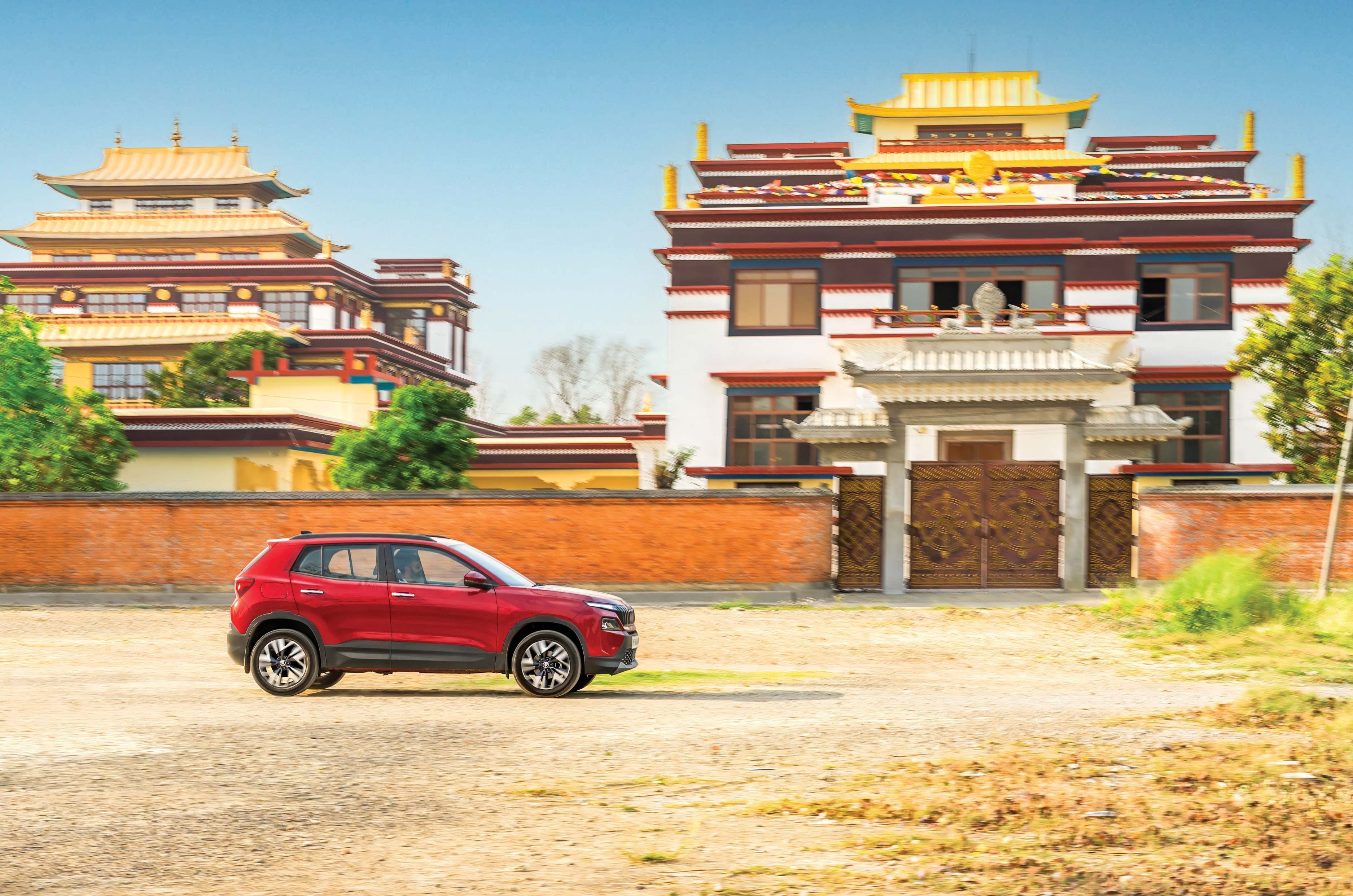
Lumbini is home to 32 unique styles of monasteries.

Next was Lumbini, a spiritual haven and, more importantly, the birthplace of Siddhartha Gautama (Lord Buddha) around 563 BC. Its fascinating monastic zone showcases monasteries built by Buddhist nations from around the world, each reflecting its own culture through design and architecture – a remarkable collection of temples spanning diverse traditions. The feeling of peace there was unlike anything I’d experienced, but it was soon disrupted by the road to Pokhara.
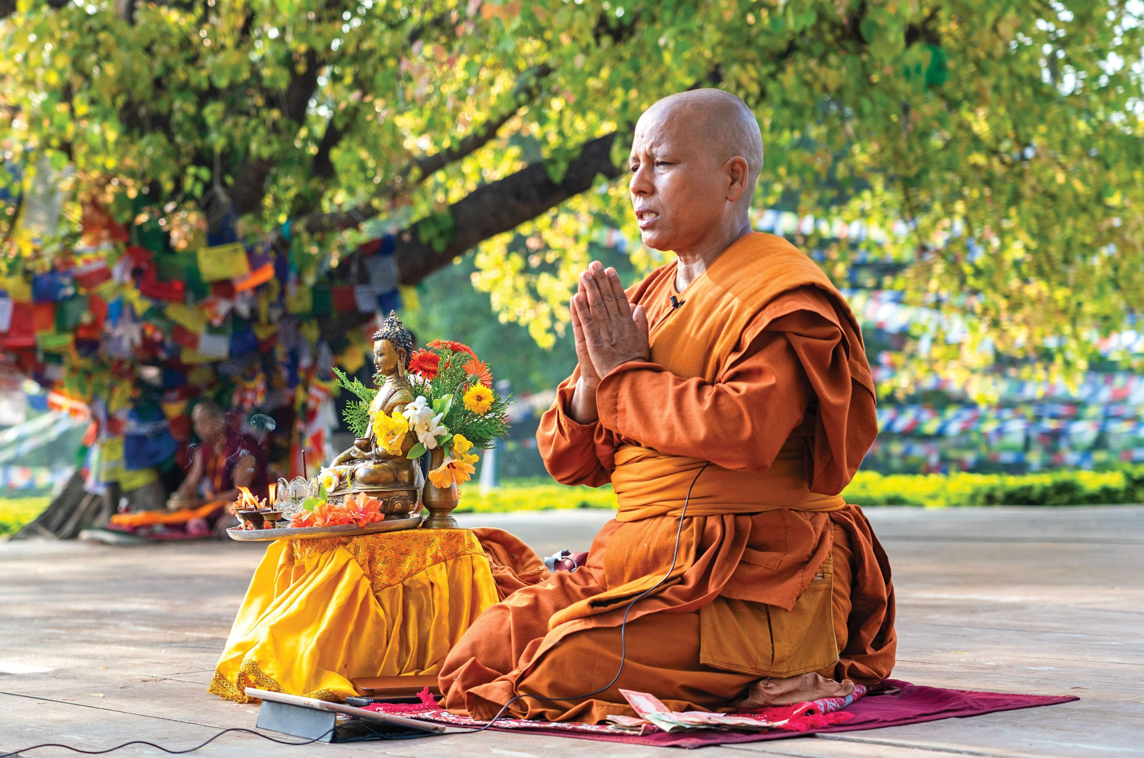
Lumbini provided a moment of calm through the chaos.

Mountain passes are notorious for destroying Google’s ETAs – landslides, breakdowns, and deteriorating roads mean a stretch that should take an hour could take five, depending on your luck. We braced for traffic and drove straight into a landslide clearing. A two-hour wait meant the sun was setting as we rolled into the quaint town of Pokhara. Bustling with cafés and pop culture, it felt like a mini Kathmandu, but with the stunning Phewa Lake turning orange at sunset. The calm that began in Chitwan came full circle on the shores of Phewa Lake.
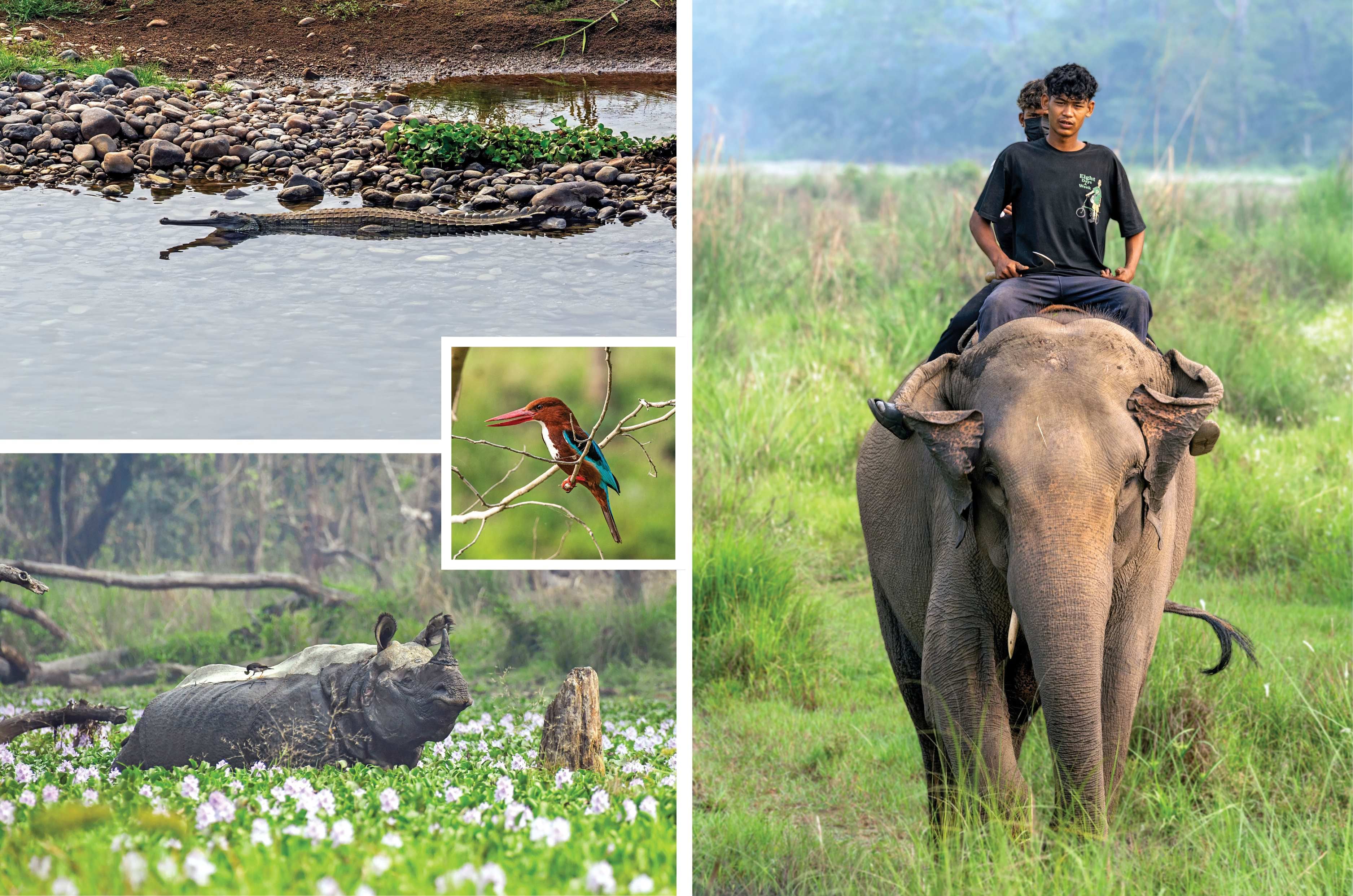
Chitwan is home to the gharial and over 700 one-horned rhinos.

Kathmandu, though, was a different animal entirely – every bit a capital city, and a world away from the slow pace of Chitwan or Lumbini. The music is loud, the traffic is hectic, and the city is anything but quiet. Ironically, the only quiet things on the road are the cars – China’s dominance in Nepal is stark, with three in five cars on the road being Chinese EVs. Geely, BYD, and GWM rule the market, with only a handful of Hyundais and Kias as competition.
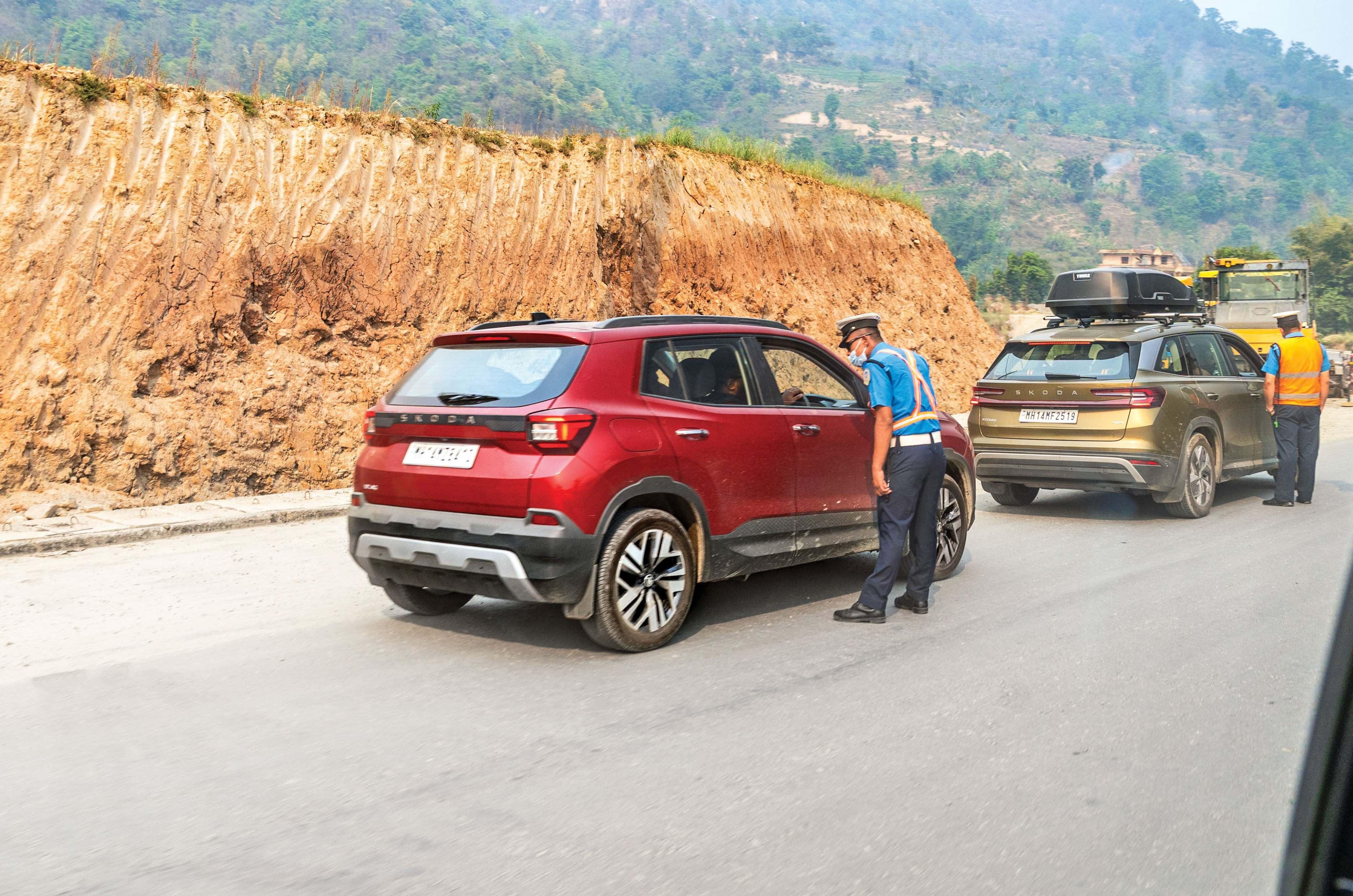
Authorities were always curious thanks to Indian number plates.

The party scene rules Kathmandu too. At night, the city comes alive as a hub for tourists from around the world. Hiking gear and North Face apparel go for a fraction of the price – and, often, a fraction of the quality – alongside quirky masks and fridge magnets at every tourist stop. Spend a little more time, though, and you’ll find excellent coffee shops and the famous Thakali thali: thick buckwheat porridge with salads, meat, and plenty of flavour. Good thing too, since walking through Durbar Square works up quite an appetite. Partly destroyed by the devastating 2015 earthquakes, the temples have since been restored to their former glory, though you can still spot the scars in a few bent pillars and roofs. It’s a culture and tradition worth preserving, and Nepal deserves credit for doing exactly that.

Birgunj-Sino-Nepal Border in numbers

Distance covered922km
Fuel consumed115.96 litres
Average fuel economy7.13kpl
Approximate fuel costRs 15,846
Average per-litre fuel costRs 136.65
Total time driven34hrs 25min
Average speed27kph

With Kathmandu explored, we headed towards our second border crossing – and this one was far more intense. Once we left Kathmandu, we left the tarmac behind too. Muddy back roads, still wet from the previous night’s rain, meant slush and a constant need for 4WD. Even so, though packed to the brim with luggage, the Kylaq stayed light enough and had enough clearance to pick its way around the mud on the approach to the Rasuwa Bridge. From there, you can see the Chinese immigration building towering over everything around it. With the Kylaq thrumming with excitement, we crossed into Tibet – the roof of the world.

Tibet/China – Roof of the World
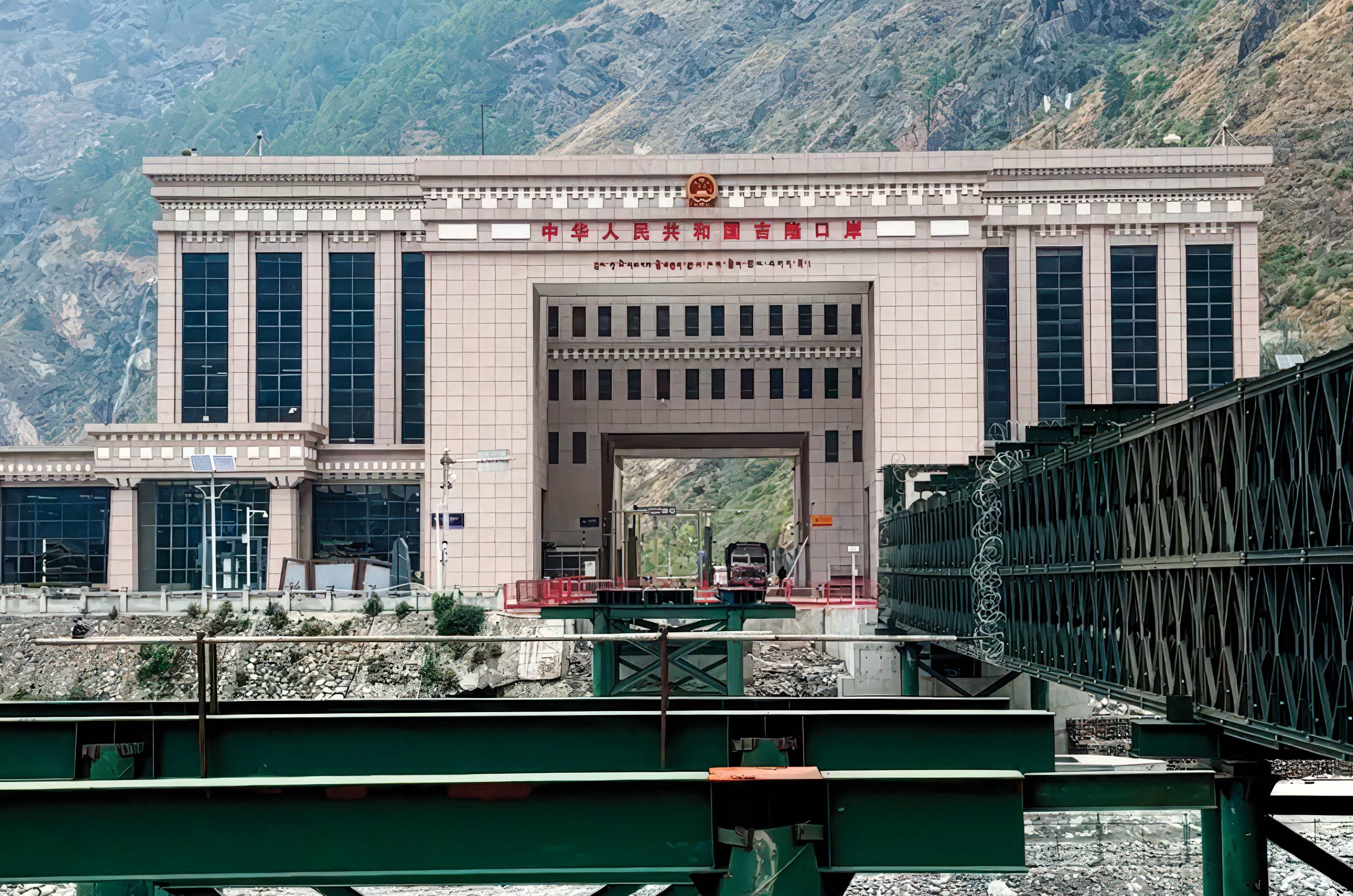
China’s border crossing is as imposing as it gets.

Crossing into Tibet felt like crossing into the future. For a region tucked deep into the mountains, it’s exceptionally developed – the roads are smooth and well-signed from the moment you cross the bridge, barely a hundred metres before the immigration office. In China, we weren’t taking any chances, knowing any misstep here could jeopardise the rest of the journey. After answering the customs officers honestly – and impressing them with the scale of the Kylaq’s challenge – we entered the lovely town of Gyirong. Old Chinese architecture, plenty of red, and signboards we couldn’t quite read were early signs that we really were in a different world now. Nepal had shared plenty with India – the cars, the food, the roads – but China felt entirely its own. We thought we’d seen our share of speed cameras, but China put us to shame – they appear every 50 metres or so, complete with flashes. There’s simply no room for error, and you’re monitored everywhere you go – aneerie feeling that takes some getting used to. Another non-negotiable is to obtain a special driving licence for every person that will be driving and a China-specific number plate, which you have to place on your dashboard so the cameras can pick up any infringements. A regular India-style RTO office with long queues and a lack of urgency got us homesick for a bit.
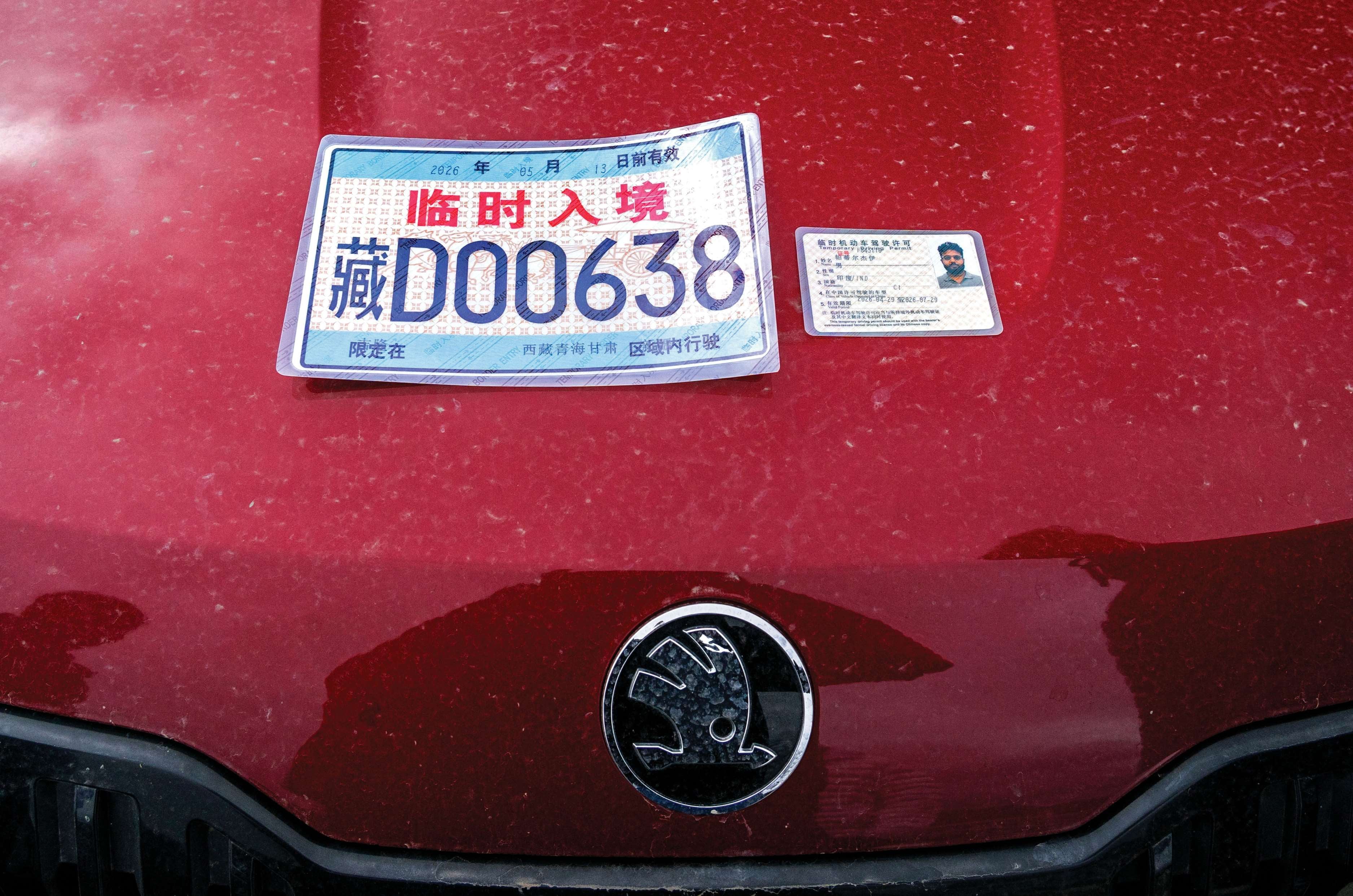
Local license and registration are non-negotiables in China.

A few mugs of hot ginger-lemon tea eased us into the chill, and we set off for Mount Everest Base Camp. High altitudes are usually punishing for small-capacity engines, but thanks to its turbocharged engine, the Kylaq barely broke a sweat, buzzing through the passes. Its 6-speed automatic had been a great convenience through the chaos of India and Nepal, but the winding mountain roads and immaculate tarmac meant I could switch to manual and take control via the paddle shifters. Paddle-shift response is often sluggish, but not here – the shifts were quick, and the taut suspension held its ground even through tight hairpins.
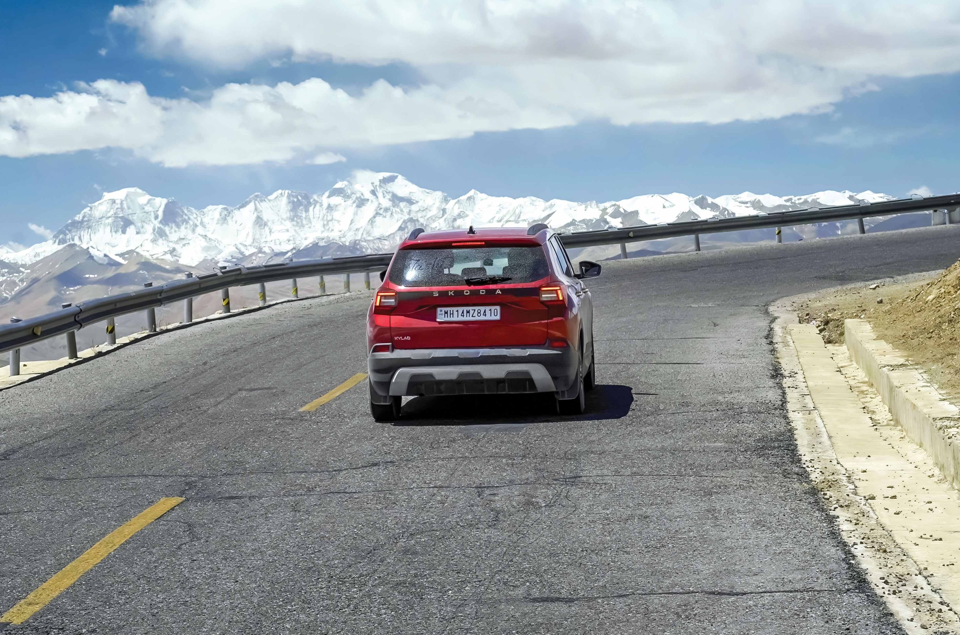
Everest hove into view long before we made it to base camp.

It made for a great drive and great footage, right up until we spotted the peak in the distance. Even from afar, Everest is breathtaking, and mercifully the clouds stayed clear as we got closer. You can’t take a car near base camp itself – a one-hour bus ride covers that final stretch. It’s strange how you lose your breath as you approach Everest – partly the thin air and altitude, but you’d lose it all the same just from the view. Words don’t do it justice, and don’t be surprised if you shed a tear or two – it’s overwhelming.
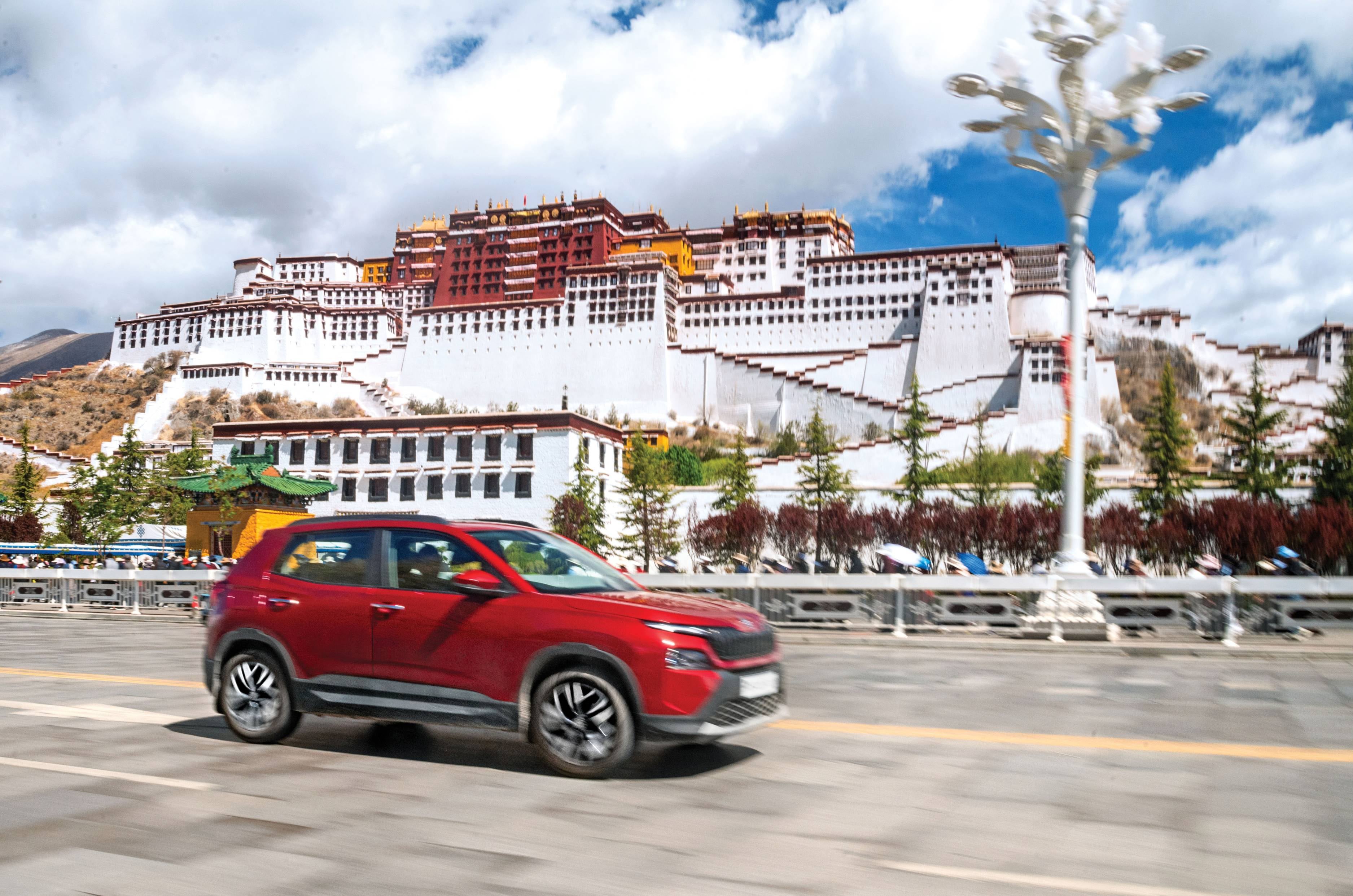
Stunning Potala Palace; once home to the Dalai Lamas.

With Everest ticked off, it was time to take on China’s vastness. We headed to Lhasa, the spiritual capital of Tibet, home to the grand Potala Palace. Once home to monks and lamas, this stunning palace holds incredible history and artefacts – spiritual or not, its significance to the country’s history is unmistakable. The drive kept revealing itself through unique food, dialects, faces, and even geography. One day we were freezing thousands of feet above sea level; days later, in Turpan, we were below sea level in blistering heat. From boiling hotpots to grocery-store instant noodles, China pushed us well outside our comfort zone, and the Kylaq wasn’t spared either.
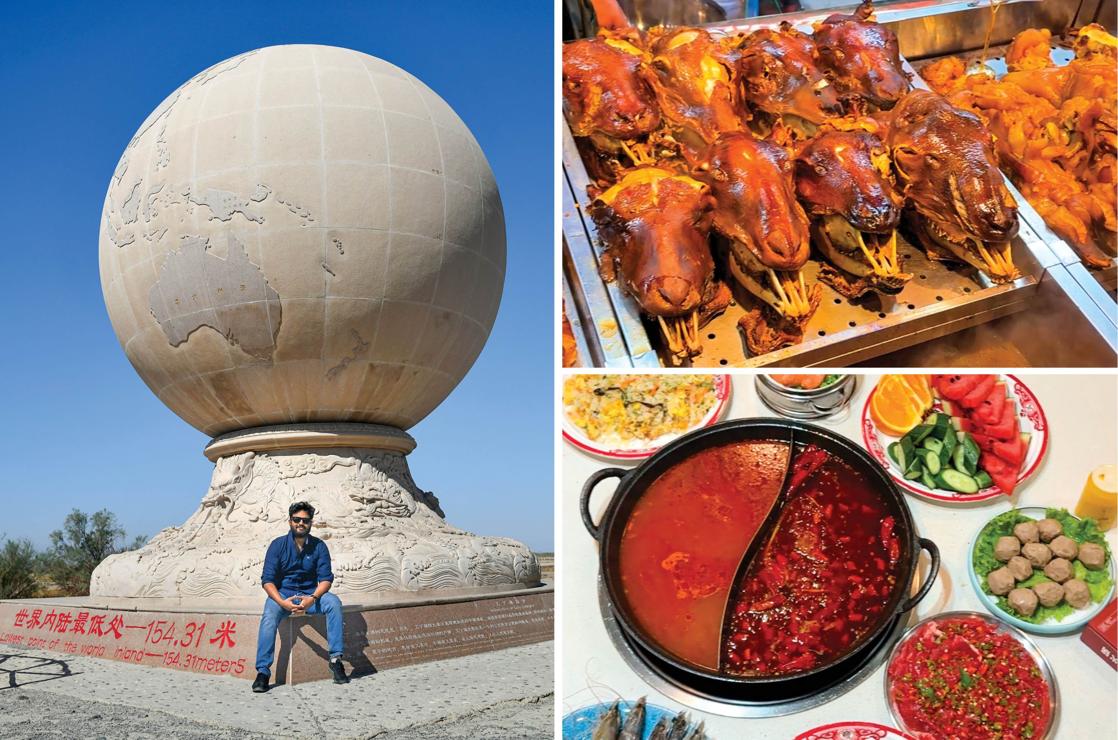
L: From EBC’s high to Turpan Depression’s low – Jay was at 154m below sea level here. R: Street food in China not
for the faint-hearted.

Two full days on the way to Golmud were entirely off-road, taking over 13 hours of driving, with our average speed dropping to 18kph as the Kylaq waded through water up to its bonnet and emerged without complaint.
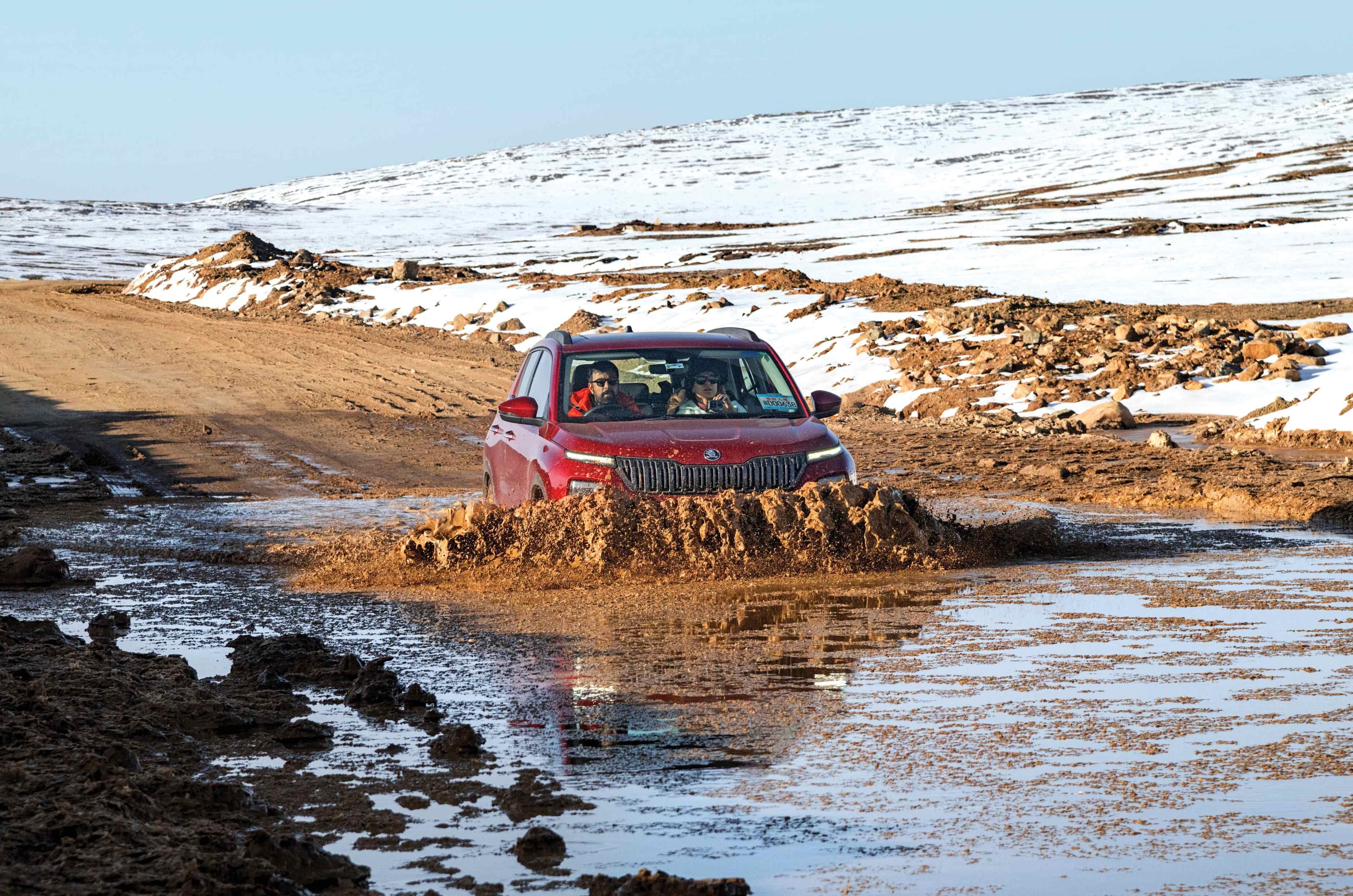
In China, you get perfect roads or, simply, no roads.

A stretch that would have broken most cars left the Kylaq unscathed. China hit hard, but the Kylaq hit back harder. From day one, it had faced challenge after challenge, and from day one, it had come out on top. Three countries in, it still carried the same zeal it started with – and while we were rattled, it stood strong each night, ready for the next day.

China-Kyrgyz Border in numbers

Distance covered5,133km
Fuel consumed330.88 litres
Average fuel economy15.51kpl
Approximate fuel cost3074 Yuan (Rs 42,764)
Average per-litre fuel cost9.2 Yuan (Rs 129)
Total time driven117hrs 21min
Average speed43.80kph

Exploring Utah in a Ford Expedition: Utah by the book

Exploring Utah in a Ford Expedition: Utah by the book
UTAH BY THE BOOK

In the analogue age, I planned road trips with paper maps, fluorescent highlighters and dog-eared guidebooks. Lately, however, Uncle Claude and Aunty Gemini have lured me into the world of artificial intelligence. When I asked them to suggest an adventurous drive through south Utah, they both recommended similar itineraries. It was like asking the chef at a dhaba to surprise me with something unusual and being served butter chicken instead. Zion, Bryce Canyon and Arches. Three magnificent National Parks connected by smooth highways and comfortable hotels.

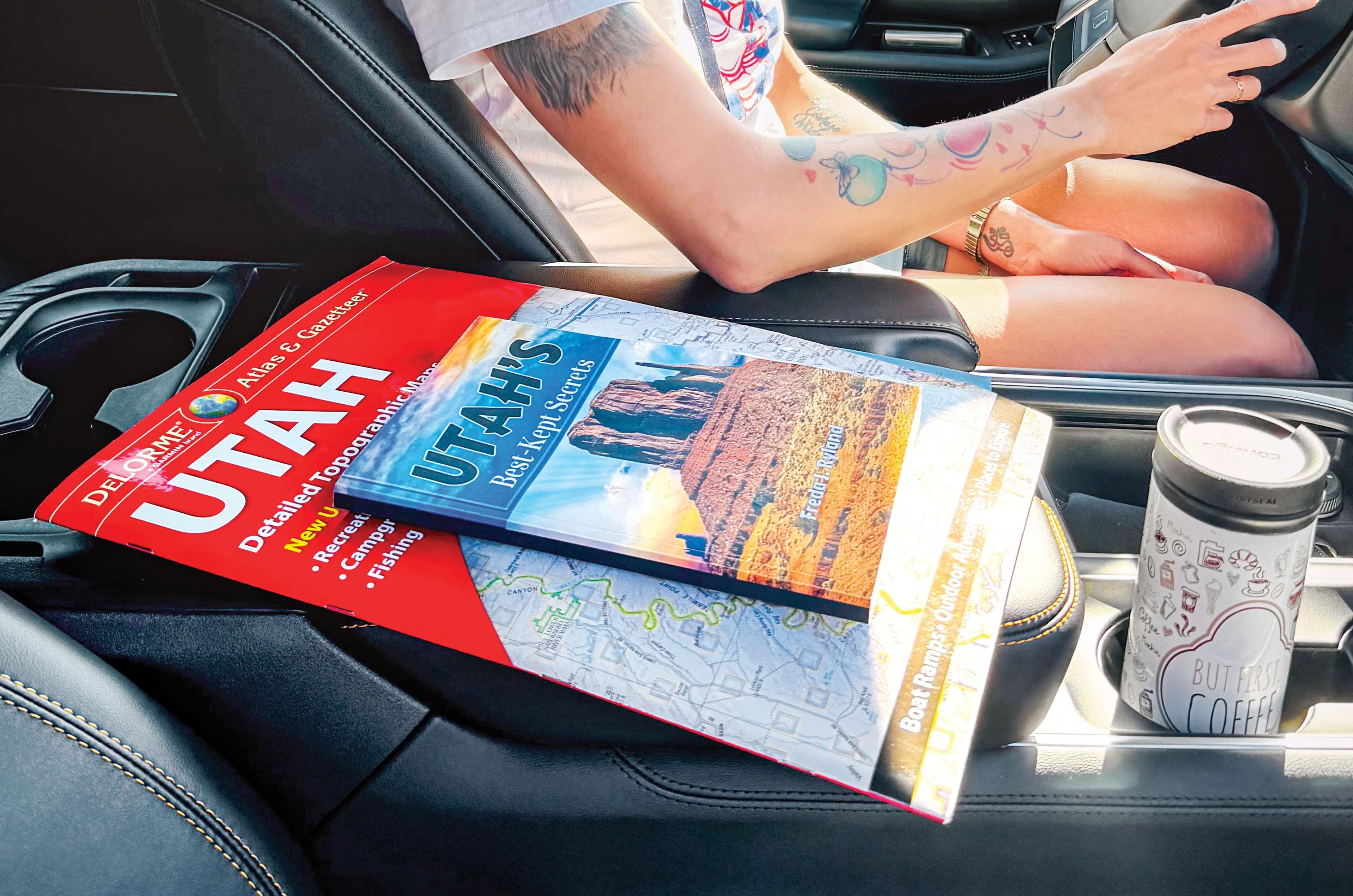
Our search engine for Utah beyond the tourist trail. No signal required.

This route hits Utah’s greatest highlights, featuring soaring cliffs, towering hoodoos and delicate sandstone arches. However, the parks are often so busy that sedans circle overflowing car parks, rather like sharks patiently circling a lifeboat. I wanted roads that filtered out sedans and coaches, demanded preparation and delivered adventure, where the SUV became part of the journey rather than mere transport.

So, I turned my back on the algorithm and went analogue. While ordering the DeLorme Utah Atlas, Amazon suggested Freda J. Ryland’s Utah’s Best Kept Secrets, promising another Utah of mesas, switchbacks, unspoiled canyons, lonely dirt roads beyond the cellular umbrella and skies dark enough to make galaxies glow.

Her book was fuel for wanderlust; an invitation into a hidden Utah for those willing to stray off the tarmac. Though its typesetting suggested a clandestine hand-operated press during the Quit India movement, its content was pure gold. Paired with the DeLorme atlas and offline Gaia GPS, the trio was as dependable as egg, bacon and toast. Freda chose the destination, the atlas found the route, and Gaia confirmed where we were. What followed often felt like driving into a fairy tale.

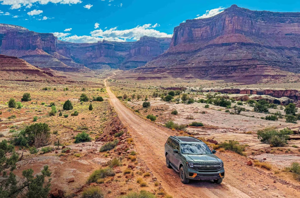
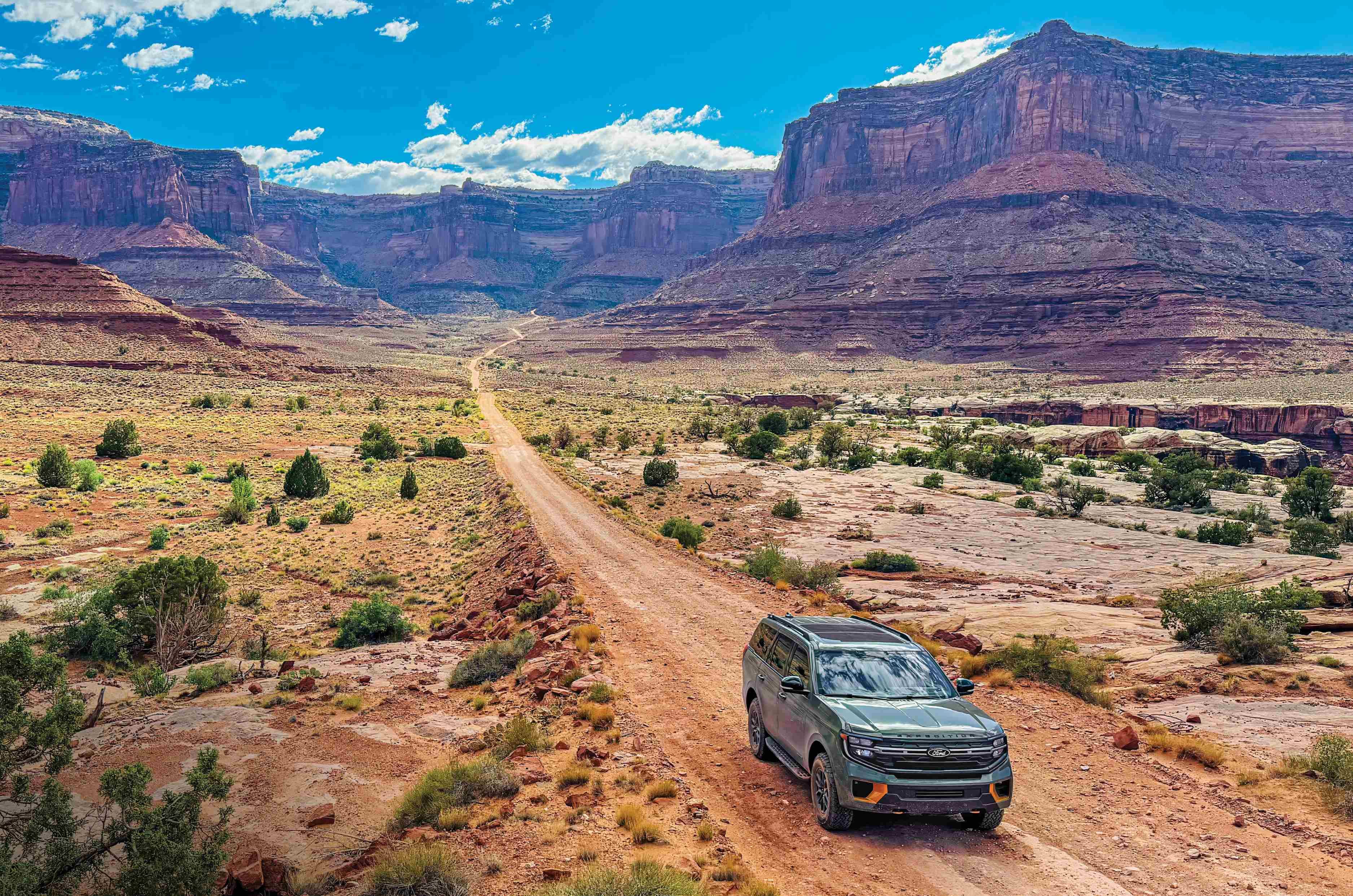
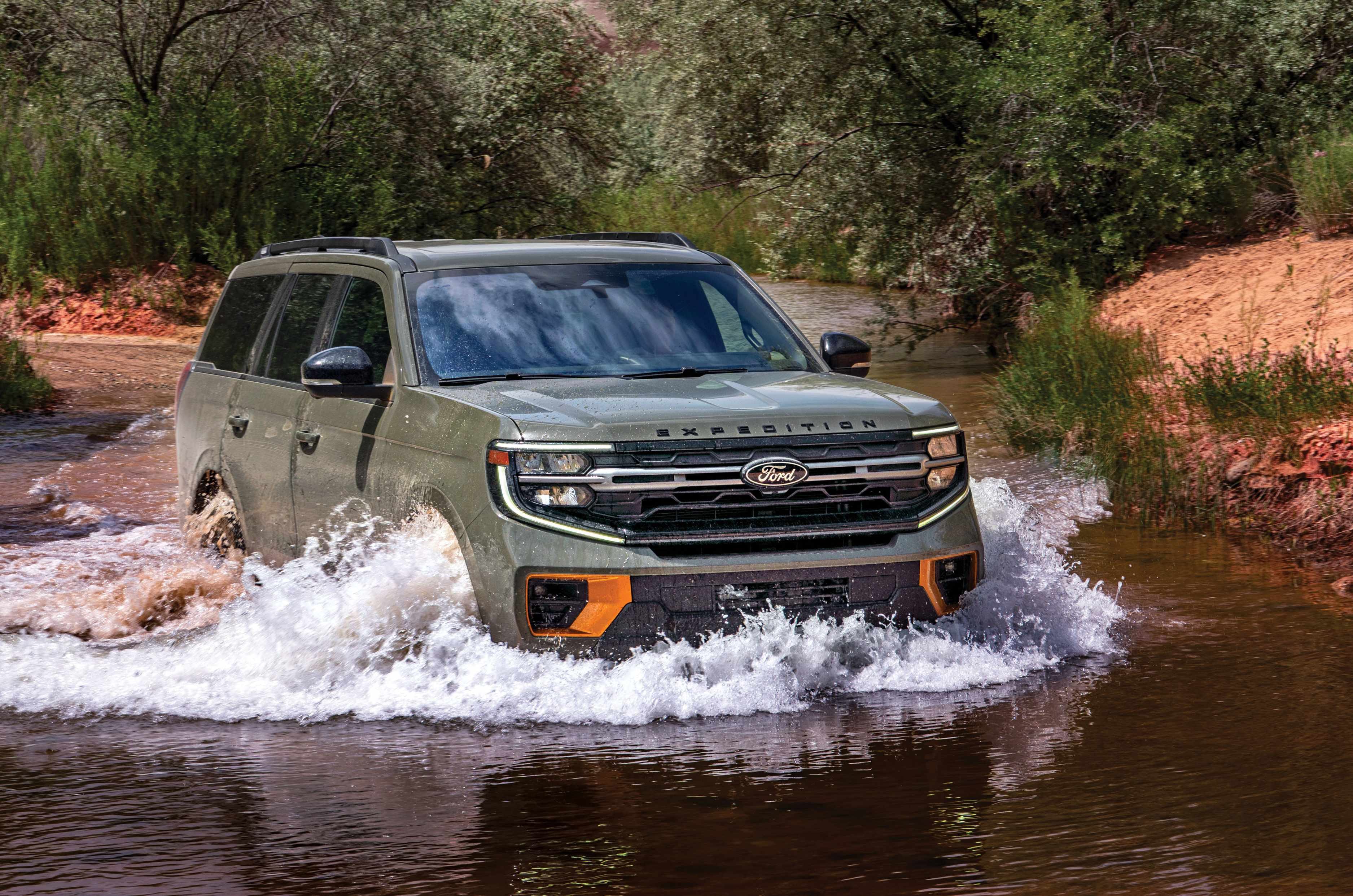
Off-grid Utah demands a dependable 4×4. The Tremor waded rivers, shrugged off loose gravel, tenacious clay and steep gradients, and kept going long after the tarmac lost interest.

None of it would have happened without the Ford Expedition Tremor, our fairy godmother. A tad tubby at over two tonnes, it came with a locking rear differential instead of a magic wand. The twin-turbocharged 3.5-litre EcoBoost V6 dispatched highway miles effortlessly. Once the tarmac disappeared, the Tremor earned its keep, shrugging off clay, loose rock, river crossings and deeply rutted tracks with nonchalant competence.

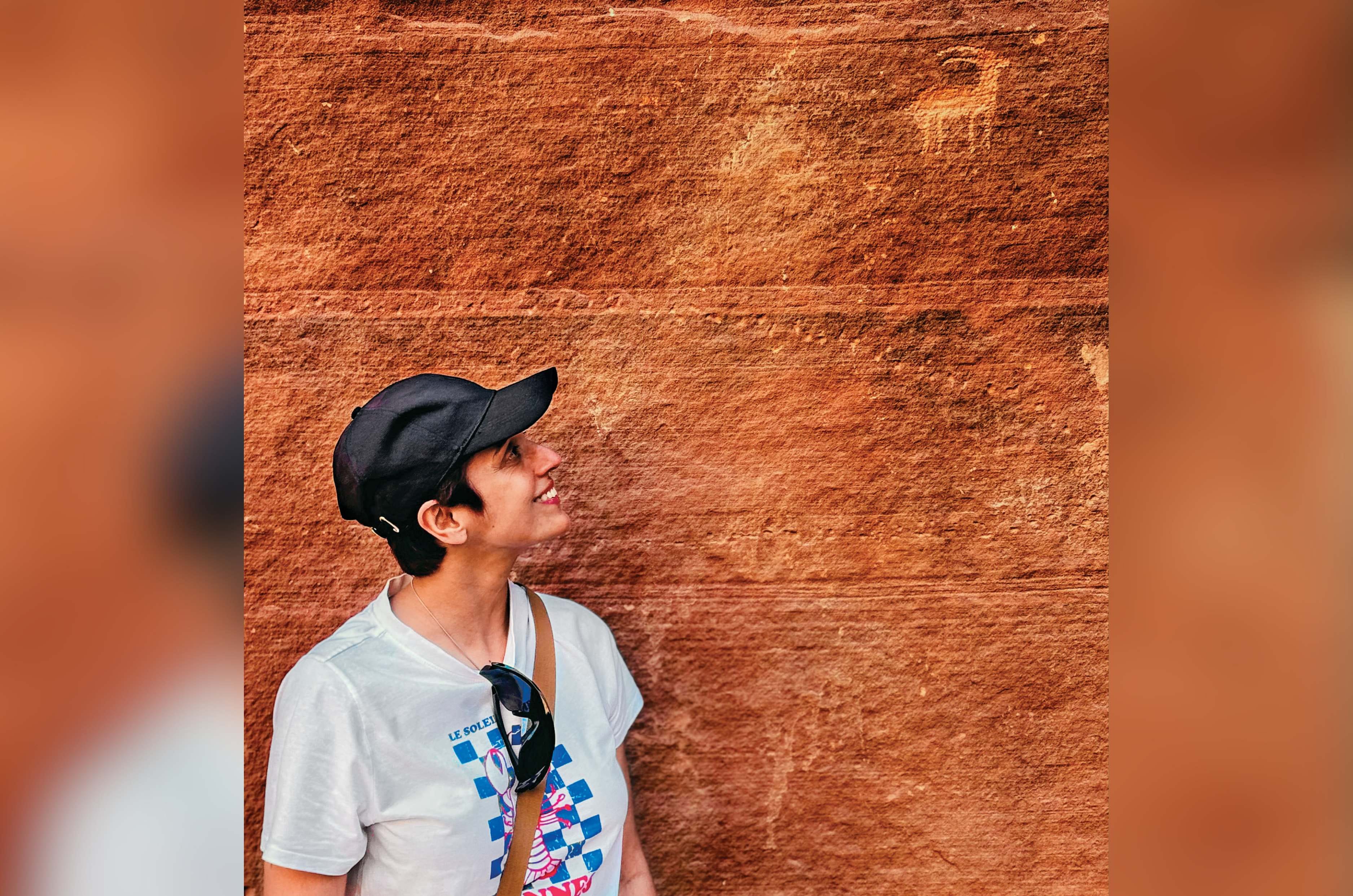
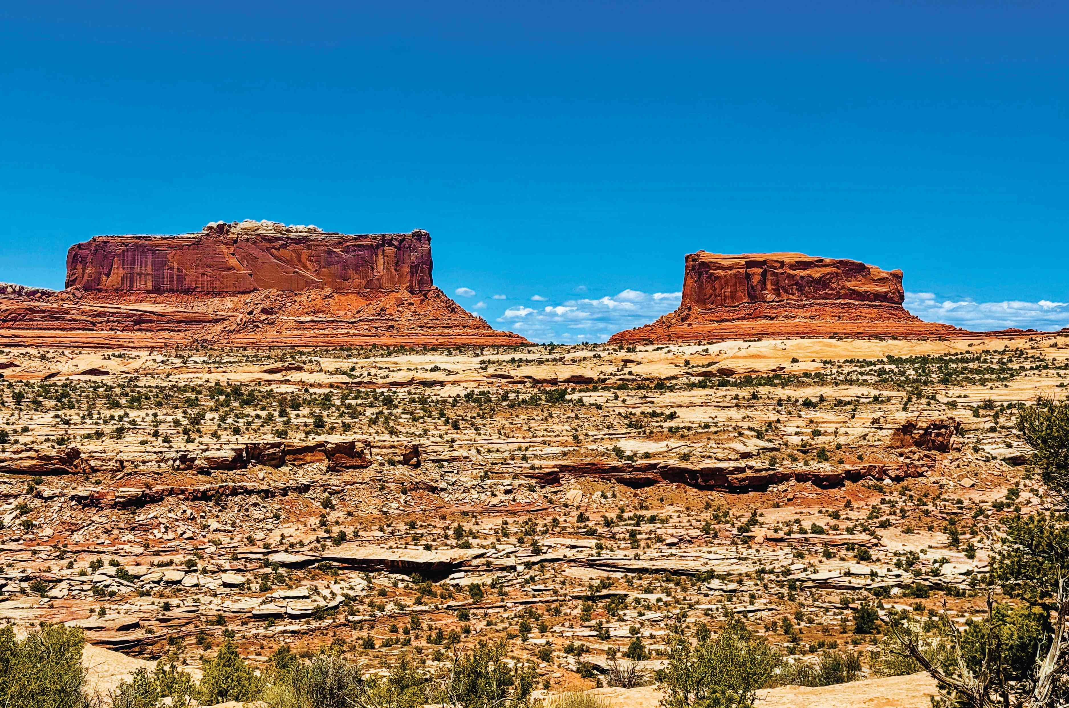
Follow her gaze. A long-gone artist still finds an audience a thousand years on. Utah is peppered with petroglyphs.

We forayed deeper into Utah’s wild, unadulterated beauty, beyond the tourist grid. To secret trails and solitude, to dinosaur tracks in ancient rock and to petroglyphs spanning two millennia, many still a mystery. I couldn’t help wondering if some ancient scribbling was simply the 2 BC equivalent of ‘Vinod loves Veronica’.

The first road to justify Freda’s confidence was Utah Scenic Byway 12, climbing out of Escalante towards Boulder through the folded canyons of Grand Staircase-Escalante National Monument, among the last regions in the contiguous US to be properly surveyed. Past Calf Creek, the road narrowed onto a hogback, a ribbon of blacktop along a ridge, with the ground dropping hundreds of feet on both sides. Red rock canyons fell open left and right, and for a few minutes it felt like driving along the spine of the Earth.

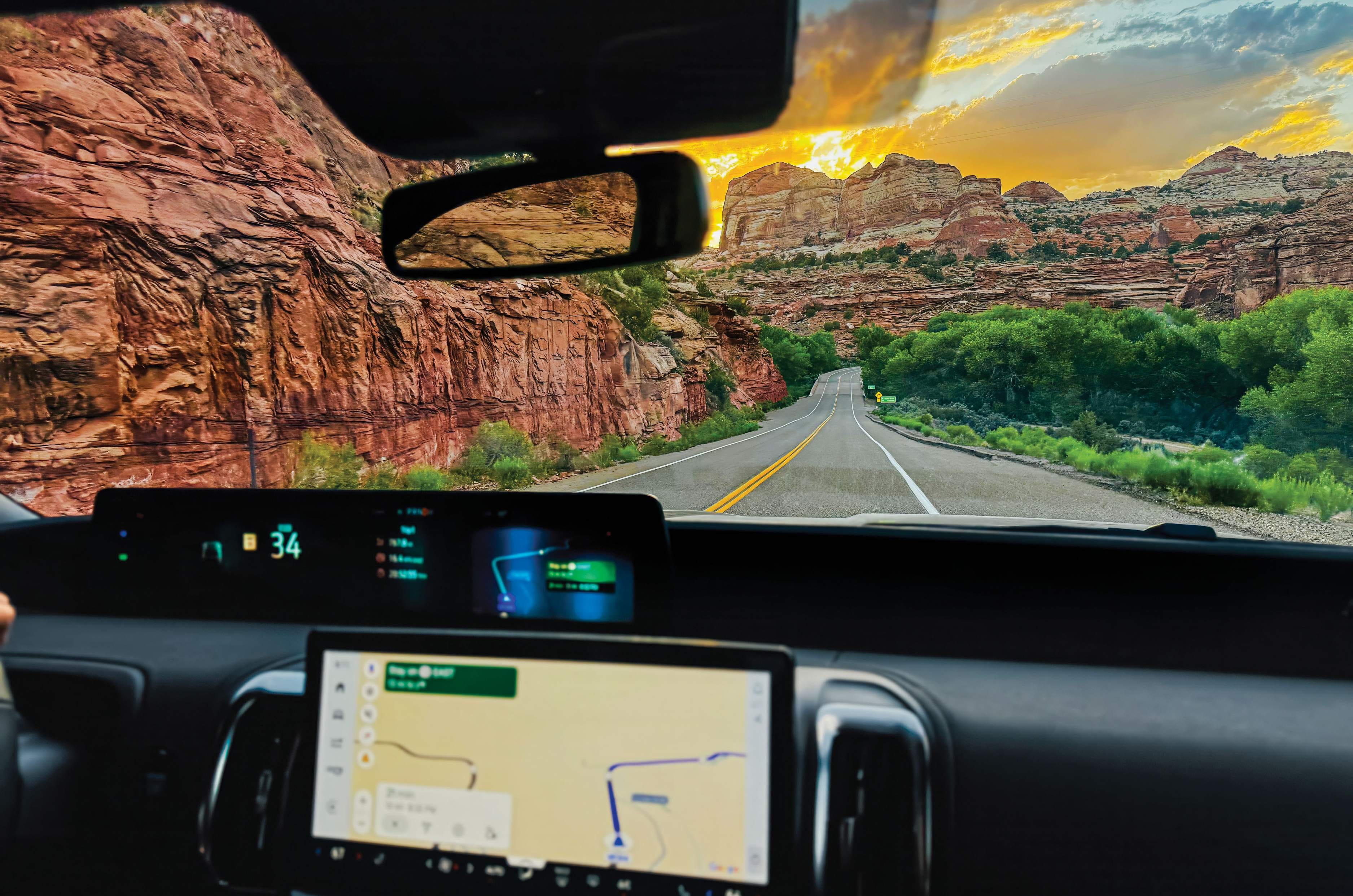
The windscreen became Utah’s widescreen, live streaming breathtaking views with hardly a break. This is Scenic Byway 12 between Escalante and Boulder.

At Boulder, we turned onto the Burr Trail, first beaten into the landscape by cattleman John Burr in the mid 1800s. Soon the road slipped past Long Canyon, colloquially called Singing Canyon because its towering, tapering walls possess the sort of acoustics that could make a bathroom baritone believe he had missed his calling. I sang a few notes and was astonished when the sandstone tuned my discordant tone to the smoothness of Sinatra.

Then the scenery became rather more serious. In 1948, the Atomic Energy Commission arrived looking for uranium, widening the trail and blasting switchbacks that tumble nearly 800 feet in less than a mile into the Waterpocket Fold, a colossal wrinkle in the earth running nearly a hundred miles across southern Utah, its tilted rock exposed in great bands of colour. We descended towards Ticaboo as the Fold surrendered to open desert.

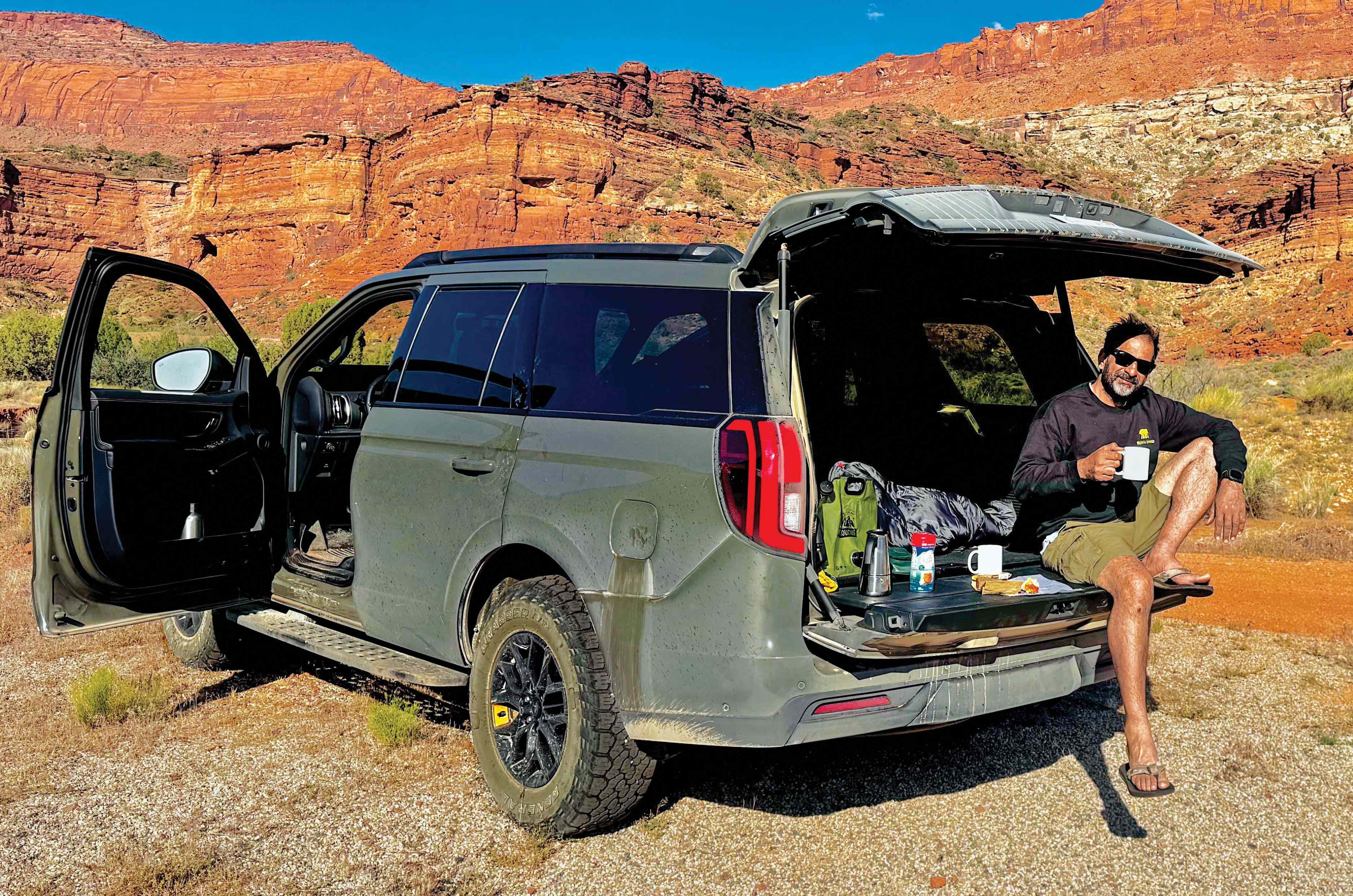
Morning coffee on the tailgate. The Expedition’s roomy interiors meant we could pull up and spend the night wherever we fancied.

We were hoping to camp at Muley Point, but we hadn’t accounted for Utah waylaying us with stupendous scenery, another slot canyon or lonely butte persuading us to stop every few miles. Around sunset, Muley Point was still hours away, so we turned into a secluded canyon and spent the night there, one of the trip’s happiest failures. We dropped the two rear seat rows into a flatbed, laid out a mattress, and slept under a sunroof full of stars and the Milky Way. We had camped at the base of the Henry Mountains, so remote that surveyors called them the Unknown Mountains until 1869.

The next morning, we pushed on to Muley Point through Bears Ears National Monument, named for a pair of buttes that really do resemble a bear’s ears poking above the treeline. An unmarked turn led to Muley Point, where the land simply stops a thousand feet above the San Juan River’s looping canyons, with views stretching to Monument Valley.

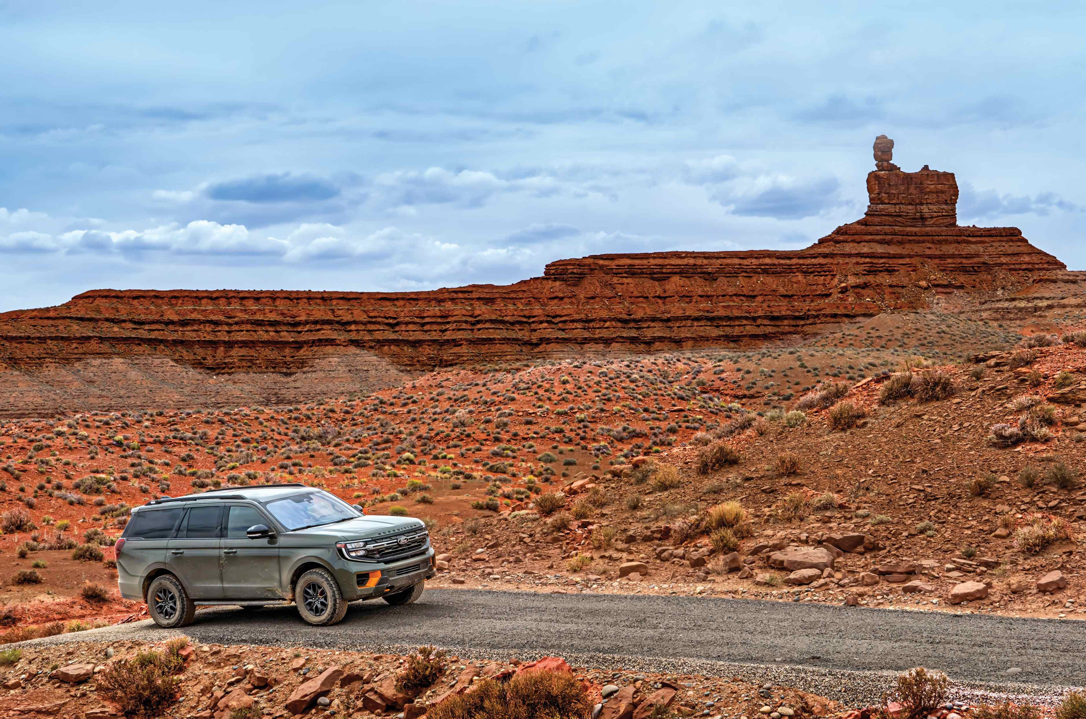
Look at the rocks above the Expedition. See anything? Someone did, and named it Lady in the Bathtub. Now try unseeing it. Welcome to the Valley of the Gods, where mesas and buttes come with wonderfully imaginative names.

Our next destination was the Valley of the Gods, the guidebook’s hidden Monument Valley twin. But first came the Moki Dugway, three miles of unpaved switchbacks blasted into Cedar Mesa in 1958 for trucks hauling uranium ore, dropping 1,100 feet at an 11 percent grade. The Tremor accepted the challenge with the calm assurance of a seasoned mountain guide.

At the bottom, a short detour brought us to Goosenecks State Park, where the San Juan River travels almost six miles in meanders to advance barely a mile and a half as the crow flies. From there, we turned into the Valley of the Gods, a dirt road meandering between sandstone monuments, nature’s own sculptures, with eccentric names. One was the Lady in the Bathtub. Had I not known the name, I might have seen only a rock. But once told, there she was, sitting bolt upright at one end of an enormous bath, her hair piled high and her back rather primly straight.

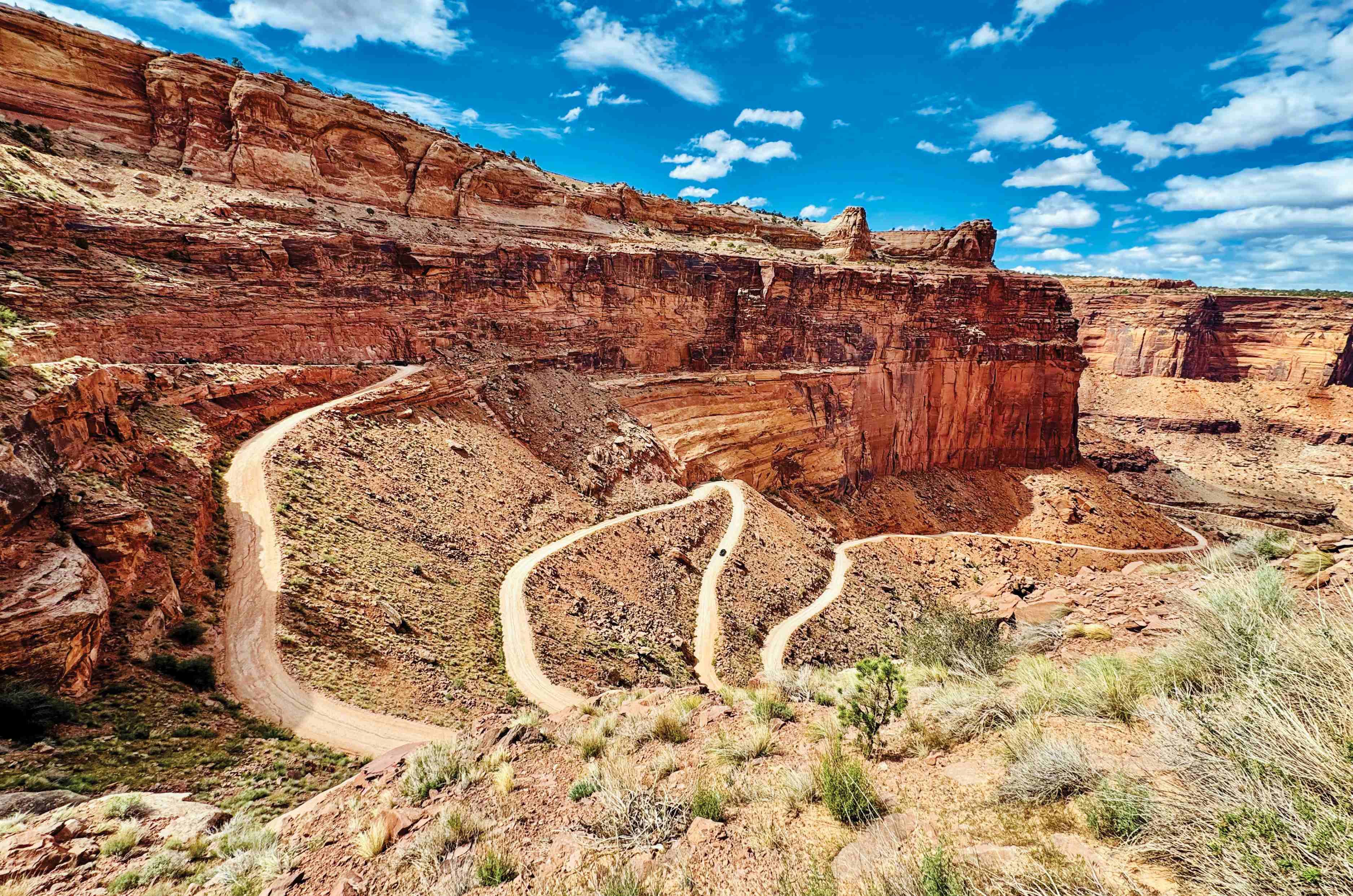
The Shafer Trail looked less like a road and more like a cartographer’s casual squiggle joining the top and bottom of a sandstone cliff. Then we drove it.

We slept another night in the car at the base of Rooster Butte, then rolled into urban Moab, our base for exploring the Needles and Island in the Sky districts of Canyonlands National Park, including the strange geological puzzle of Upheaval Dome. The highlight, though, was driving the Shafer Trail.

From the top, it was hard to believe vehicles drove down what looked like a pencil sketch etched onto a sandstone cliff.
The trail began as a foot route, widened for cattle by rancher John “Sog” Shafer, then again in the 1950s for the uranium trucks that shaped the Burr Trail and Moki Dugway.

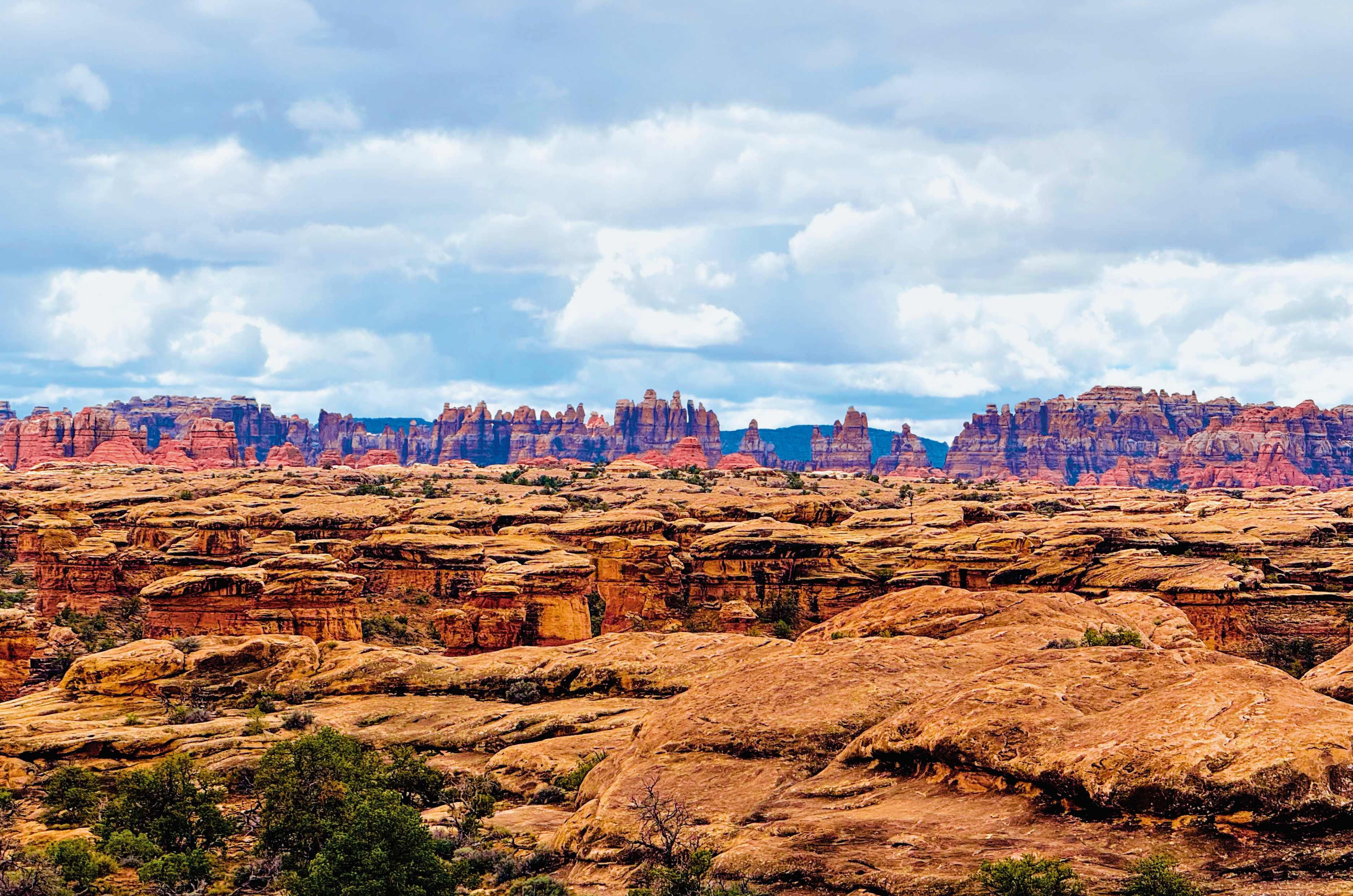
The Needles, Canyonlands – a forest of red and white banded sandstone spires, stained by iron and carved improbably thin by water patiently working through every crack.

The Expedition tipped over the edge, and we were committed. The Tremor crept down in low range, engine barely above idle, brakes doing quiet, constant work as gravel skittered from under the tyres. Every switchback flung the door mirror out over open air, nothing but red rock and sky where the road should have been, and my stomach dropped a beat before the front wheels found the turn. The cabin stayed eerily composed, no lurch, no scrabble for grip, while everything outside the glass insisted we should be afraid. At the bottom, the Colorado River came into view, and I exhaled properly for the first time in twenty minutes.

The warning isn’t for broken roads, but for deep clay bogs that require the torque and traction of a 4×4 to escape.

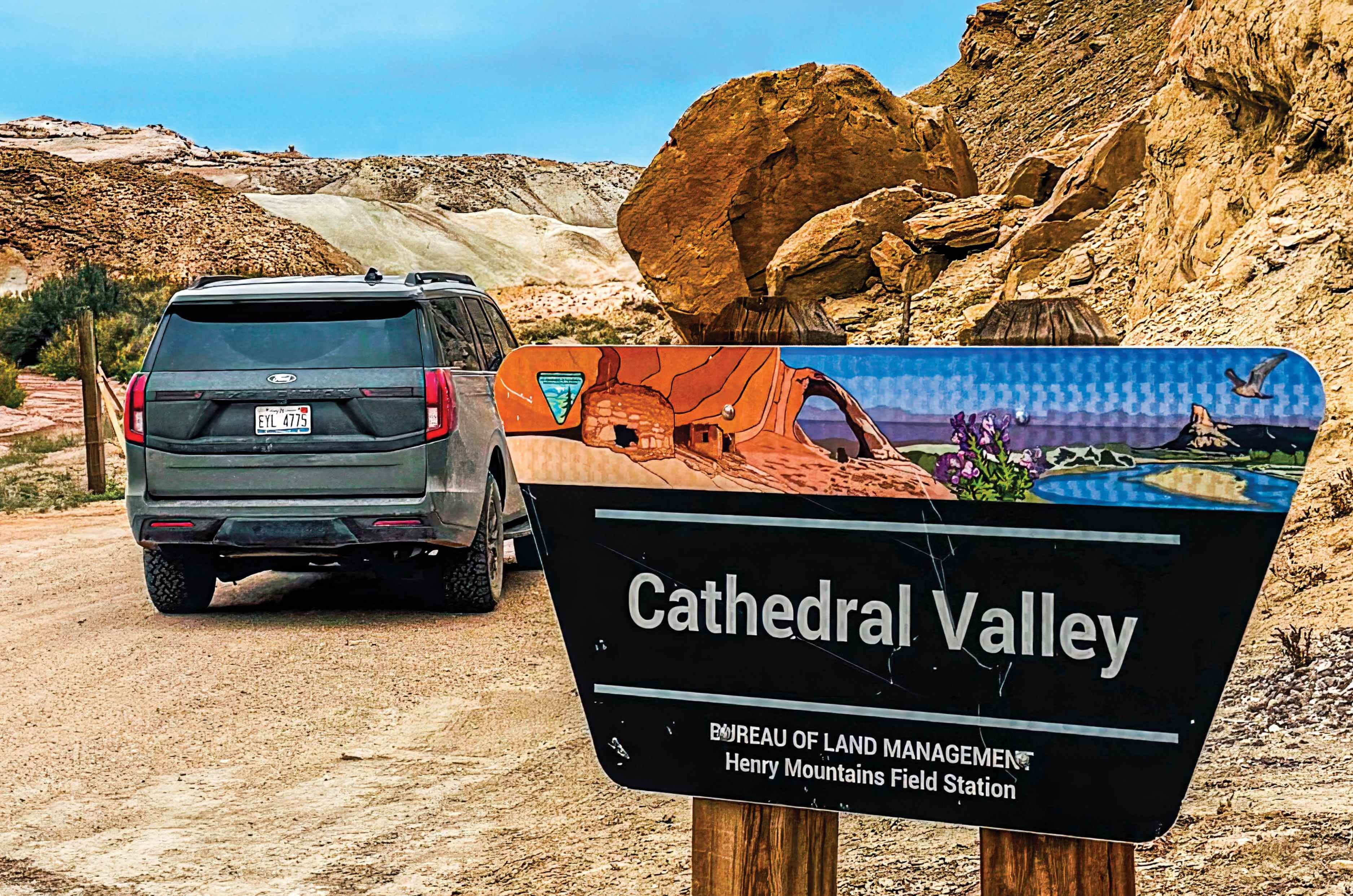
The final road I want to tell you about is the 80-mile loop through Cathedral Valley. According to Ms Ryland, this was Capitol Reef at its most remote – towering monoliths, strange badlands and perfect seclusion. At the entrance, a sign minced no words: ‘Road Impassable for Most Vehicles. Travel at Your Own Risk’.

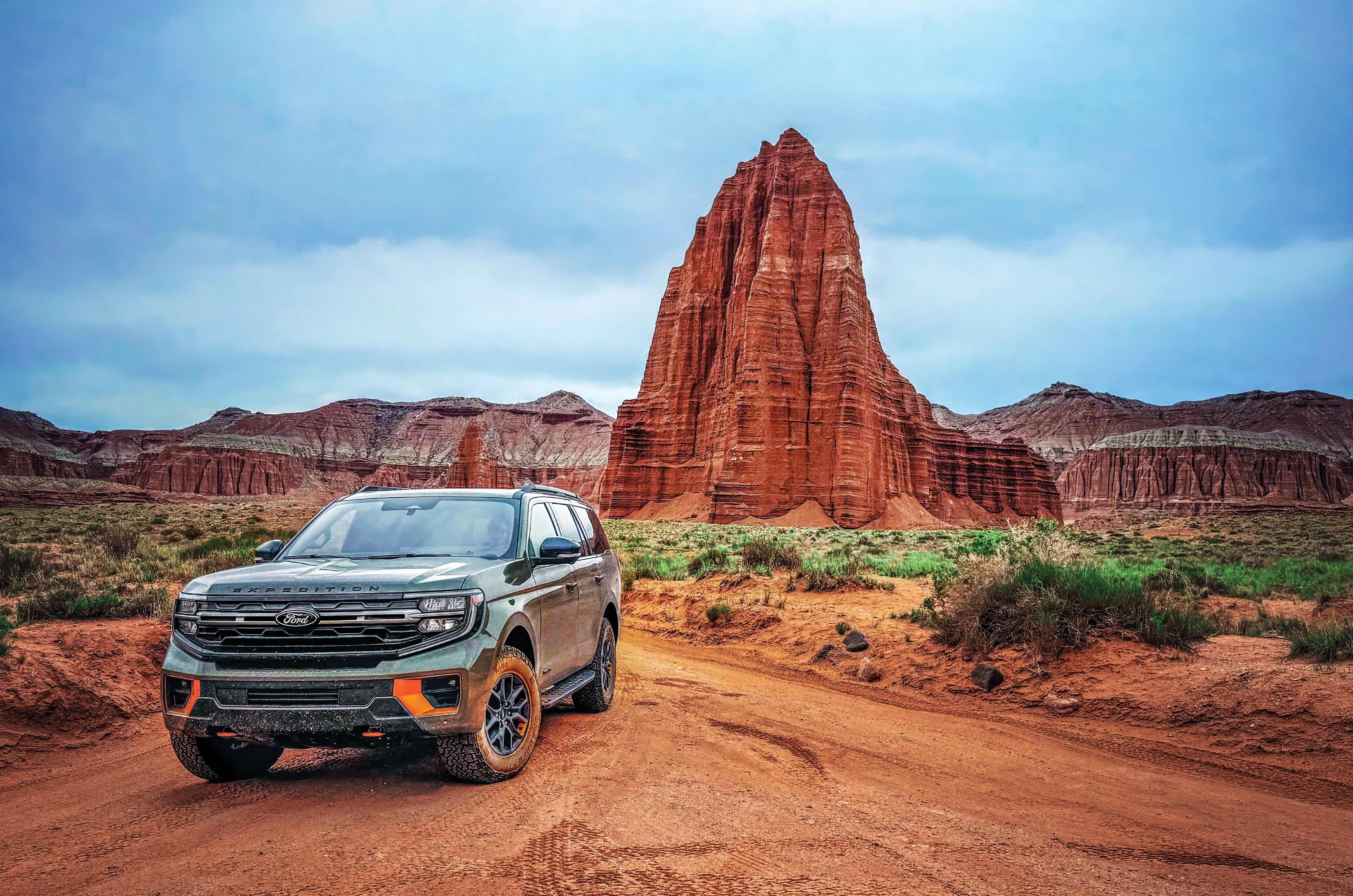
The dirt road climbs through the Bentonite Hills, bands of grey, purple and blue-green clay laid down eighty million years ago in an ancient inland sea, eroded into slopes that look lunar. Beyond them, the land opens onto a high bench where the Temples of the Sun and Moon stand, solitary honey-coloured monoliths like remnants of cathedrals of a long-lost civilisation.

What struck me most, standing before the Temple of the Sun, was how closely its silhouette echoed the thirteenth-century Temple of the Sun I knew well – still standing tall in Konark, Orissa. That was shaped by human hands wielding hammers and chisels, whereas this one by wind and water.

In the Cathedral Valley at The Temple of the Sun. Eighty million years in the making; no chisel required.

Most visitors run the Cathedral Valley Loop clockwise, meeting the Fremont River crossing at the start. We’d gone the other way, so it arrived at the very end, just short of Highway 24. Torrid brown water gushed across our path. Not crossing would mean backtracking 80 miles.

I waded in first to check for stone underfoot rather than clay, reading whether the current had strong opinions about being crossed. Satisfied, I waved the Tremor forward, and my partner drove it straight through, water climbing the doors. Then crossed again to pick me up, and once more just for fun, proof this was a vehicle built to encourage this kind of tomfoolery.

After Cathedral Valley, the long drive back to ordinary life began, the odometer past 1,300 miles. Looking back on those twelve days, I’m glad I chose the path not well trodden, as Robert Frost once suggested, in a digital age where it’s easiest to let the machines pick the route.

A badly printed, albeit meticulously researched book, an atlas, and a Ford that never once flinched had taken us somewhere far better than any algorithm would have dared suggest. Rather than a destination ticked off, Utah became one truly experienced, and that made all the difference.

The essentials

Self-sufficiency matters: A little preparation separates adventure from discomfort.

Water: Carry more than you think you need. We kept 20 litres in the Expedition.

Provisions: Stock up on energy bars, trail mix, fruit, chocolate, canned food, instant noodles, jerky and coffee. A camping stove is invaluable for hot meals in the middle of nowhere.

Fuel: Fill up whenever you can. Distances are vast and stations scarce.

Navigation: Download offline maps and carry a paper atlas. The DeLorme Utah Atlas and Gaia GPS worked well.

Clothing: Hot days, cold nights. Pack a warm layer and a sleeping bag.

Footwear: Sturdy hiking shoes.

Sun protection: A wide-brimmed hat, sunglasses, sunscreen and lip balm.

Vehicle: A high-clearance 4WD.

In-car essentials: First-aid kit, head torch, tyre gauge, air compressor and puncture repair kit.

Allow extra time. Utah ambushes you with one view after another, and the best memories happen at unplanned stops.

550 साल पुराने इस मंदिर में पानी नहीं, इस्तेमाल हुआ था 40 हजार किलो घी! वजह कर देगी हैरान

राजस्थान के बीकानेर में मौजूद भांडासर जैन मंदिर अपनी अनोखी कहानी और शानदार स्थापत्य कला के लिए मशहूर है। करीब 550 साल पुराने इस मंदिर से जुड़ी कई ऐसी मान्यताएं हैं, जो इसे देश की अन्य धरोहरों से अलग बनाती हैं। कहा जाता है कि इसके निर्माण में पानी की जगह हजारों किलो घी का इस्तेमाल किया गया था। यही वजह है कि यह मंदिर इतिहास, आस्था और रहस्य का अद्भुत संगम माना जाता है। इसकी खूबसूरत नक्काशी, रंगीन चित्रकारी और प्राचीन वास्तुकला देखने के लिए हर साल बड़ी संख्या में पर्यटक यहां पहुंचते हैं।

हालांकि घी से निर्माण की कहानी को लेकर कई तरह की चर्चाएं हैं, लेकिन यही लोककथा इस मंदिर को और भी खास बना देती है। सदियों बाद भी यह मंदिर अपनी अनोखी पहचान और आकर्षक विरासत के कारण लोगों को हैरान करता है।

पानी की कमी ने बदली निर्माण की कहानी

मंदिर का निर्माण वर्ष 1468 में जैन व्यापारी भांडासा ओसवाल के संरक्षण में शुरू हुआ था। उस समय बीकानेर क्षेत्र में पानी की भारी कमी थी। स्थानीय परंपराओं के अनुसार, इसी समस्या के कारण मंदिर के गारे (मोर्टार) में पानी की जगह घी का उपयोग किया गया, जिसने इस मंदिर को बाकी धरोहरों से अलग पहचान दिलाई।

एक बूंद घी से शुरू हुई अनोखी दास्तान

लोककथा के मुताबिक, एक बार एक वास्तुकार ने भांडासा ओसवाल को गिरे हुए घी की एक बूंद बचाने को लेकर ताना मारा। इस बात से प्रेरित होकर व्यापारी ने ऐसा मंदिर बनाने का संकल्प लिया, जिसमें घी का इस्तेमाल ही इसकी खास पहचान बन जाए। यही कहानी आगे चलकर इस मंदिर की सबसे प्रसिद्ध किंवदंती बन गई।

कई दशकों में पूरा हुआ भव्य निर्माण

भांडासा ओसवाल का निधन 1514 में हो गया, लेकिन मंदिर का निर्माण कार्य रुका नहीं। कई कारीगरों और पीढ़ियों के प्रयासों के बाद यह भव्य जैन मंदिर लगभग 1554 में बनकर तैयार हुआ।

सोने की चमक और कलाकारी का अद्भुत नमूना

यह मंदिर जैन धर्म के पांचवें तीर्थंकर भगवान सुमतिनाथ को समर्पित है। इसकी दीवारों और छतों पर शानदार राजस्थानी कला देखने को मिलती है। यहां की बारीक भित्तिचित्र कला, शीशे का काम और सोने की पेंटिंग्स 24 तीर्थंकरों की कहानियों को जीवंत रूप देती हैं।

क्या आज भी निकलता है घी? रहस्य बरकरार

मंदिर से जुड़ी एक और लोकप्रिय मान्यता है कि गर्मियों के दिनों में इसके कुछ हिस्सों से घी या मक्खन जैसी चीजें रिसती हुई दिखाई देती हैं। हालांकि इसे लोकविश्वास माना जाता है, लेकिन यह दावा आज भी पर्यटकों की जिज्ञासा बढ़ाता है।

इतिहास और आस्था का अनोखा संगम

आज भारतीय पुरातत्व सर्वेक्षण (ASI) इस ऐतिहासिक मंदिर की देखरेख करता है। चाहे इसे वास्तुकला का चमत्कार मानें या लोककथा का हिस्सा, भांडासर जैन मंदिर राजस्थान की उन धरोहरों में शामिल है, जिनकी कहानी सदियों बाद भी लोगों को आकर्षित करती है।

NEET Protest में छाई ये ‘देसी मां’, पोस्टर पर लिखी एक लाइन पढ़कर इंटरनेट हुआ दीवाना